
Xinjiang - Beautiful Scenery of the Whole Region
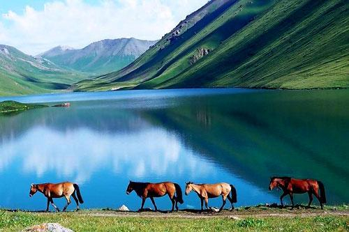
Foreword
The full text is 7800 words, with an estimated reading time of 27 minutes.
In October this year, I achieved the accomplishment of conquering all of Japan, and at the same time checked in at the four cardinal points of Japan. While contemplating next year's travel plans, I felt that I had been running around Japan in recent years, but had not yet visited many places in China. So, my friend and I decided to go to Xinjiang in November to see the magnificent landscapes of our motherland.
About the Route
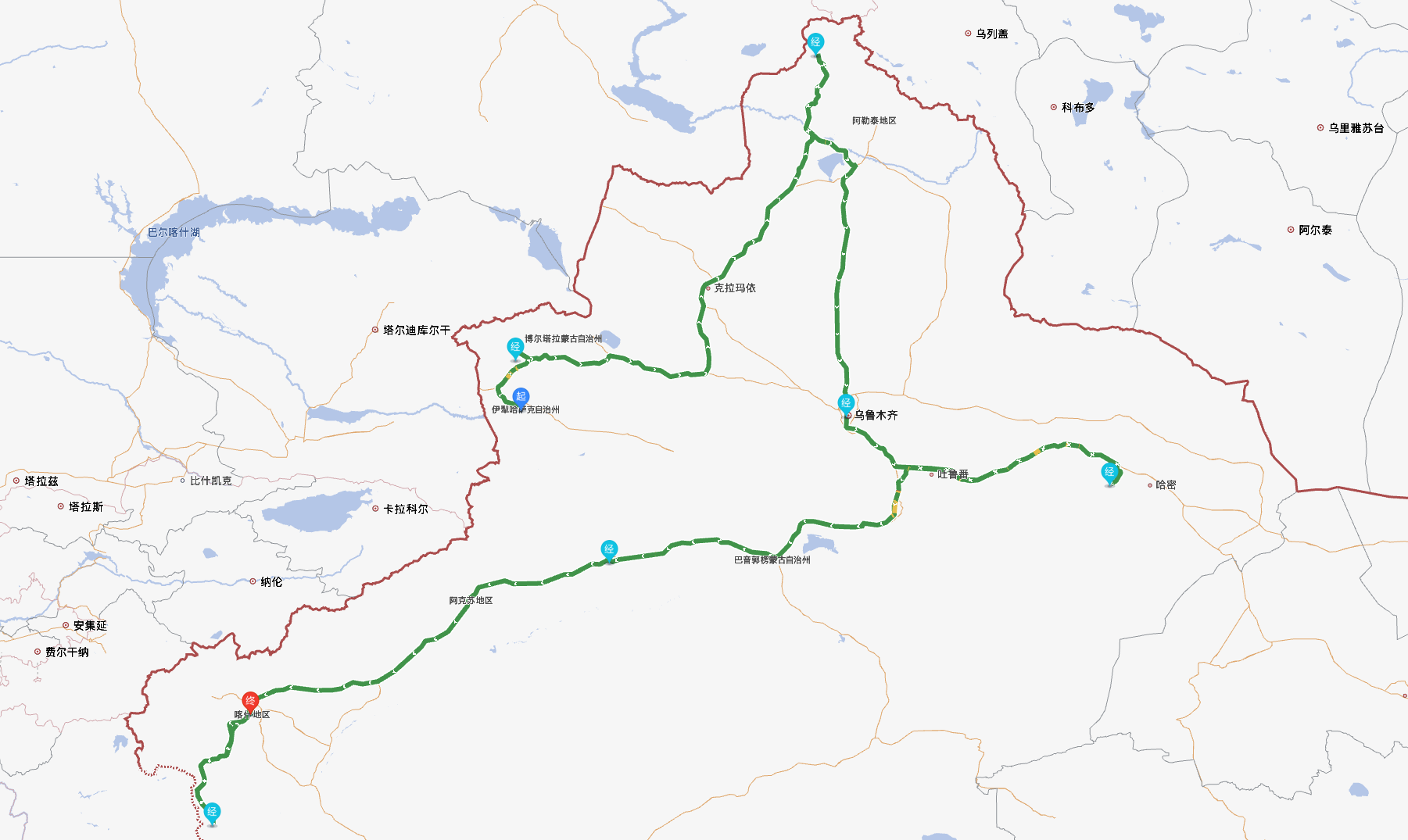
This Xinjiang trip was a self-driving tour, covering approximately 5000 kilometers in 20 days from Northern to Southern Xinjiang. We flew directly from Shanghai to Yining, passing through Sayram Lake, Karamay, Kanas, Urumqi, Turpan, Hami, Kuqa, Aksu, and Tashkurgan, finally returning from Kashgar.
Along the way, we traversed the Ahe Highway, freely driving through endless snow-capped mountains; we also drove through the desert's "Grand Canyon" (Dahaidao), witnessing unique Yardang landforms; and we safely passed through the Tashkurgan Ancient Road, reliving Xuanzang's journey to the West. In Northern Xinjiang, we saw the pristine white snow of winter; in Southern Xinjiang, we also enjoyed the late autumn Populus euphratica forests. Even now, on our way back, we still linger in our memories.
About Accommodation
This trip almost entirely opted for hotels under the HUAZHU Group: Hanting, Orange, Orange Crystal, and Mercure. When choosing specific hotels, the priority was newly opened hotels (in 2023 or 2024). Due to the newness of the hotels and complimentary breakfast every day, the experience was good for hotels in the 200-300 yuan range.
We also stayed at Atour Hotels for a few nights, hoping to experience their popular "Atour Planet Pillow Pro2," but unfortunately, either the hotels didn't have this pillow, or they only offered the first generation. Some personalized services chosen during booking were also not implemented, resulting in a very mediocre experience.
Additionally, we stayed in Hemu for a few days, and I felt that hotel pricing was inconsistent, and the hardware and software levels varied greatly. The service attitude of a 1500 yuan per night hotel was even far worse than a 500 yuan per night small wooden house.
About Equipment
Clothing
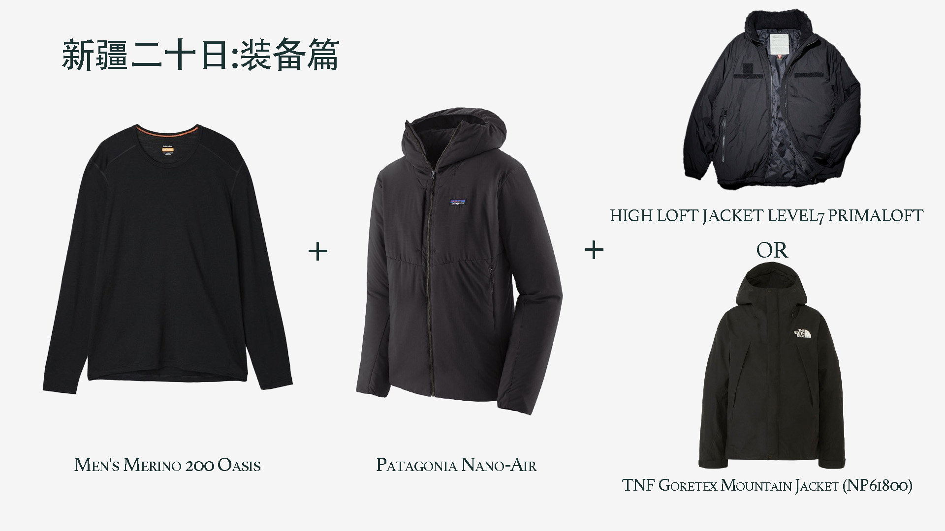
As mentioned above, the weather in Xinjiang in November is extreme: Northern Xinjiang has entered winter, while Southern Xinjiang is still in autumn. Especially in Northern Xinjiang, the temperature difference between day and night is very large, so the safest clothing choice is to bring clothes for all four seasons.
To cope with changeable weather conditions and different outdoor activities, the "three-layer dressing method" is very suitable. Taking my equipment as an example: Icebreaker 200 merino wool base layer + Patagonia Nano-Air softshell + Freak's Store P-cotton jacket, plus a hardshell jacket, which can be replaced with the cotton jacket at any time, basically coping with all weather conditions.
Photography Equipment

DJI AIR 3S + DJI Osmo Pocket 3+ GoPro 9 + Sony A7M4 +Sony G Master 100-400mm + Sony G Master 24-70mm + Sony FE 24-105mm + Fotopro X-AIRFLY Max Video
About Self-Driving
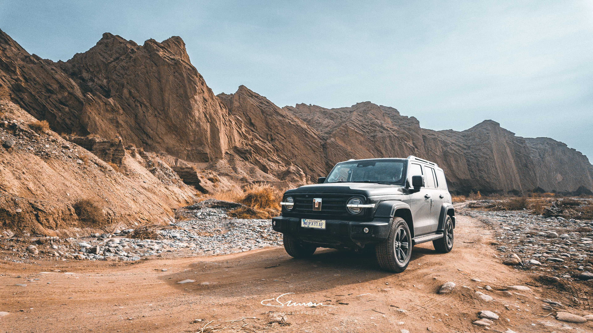
Xinjiang's area is equivalent to four times that of Japan, so choosing a suitable car for self-driving in Xinjiang is also very important. If you also want to travel off-peak in November and consider renting a car locally, I strongly recommend choosing an SUV with snow tires. Our Tank 300 + snow tire combination was a great help, whether on the snowy roads of Hemu or on the winding icy roads of the Pamir Plateau.
In addition, you should confirm in advance whether the tool kit with the car is complete at the rental shop. During the trip in Xinjiang, it is inevitable to encounter bad road conditions, so there may be a need to change tires. When we crossed the Dahaidao in Hami, we encountered a rented Tank 300 with a flat tire that could not be changed due to insufficient tools, and there was no signal on the phone to call for rescue, which was very embarrassing. Finally, with our help, the tire was changed, but it also delayed a lot of travel time.
Guozigou Bridge
Our first stop was Sayram Lake, but on the only way to Sayram Lake, we encountered the famous Guozigou Bridge.
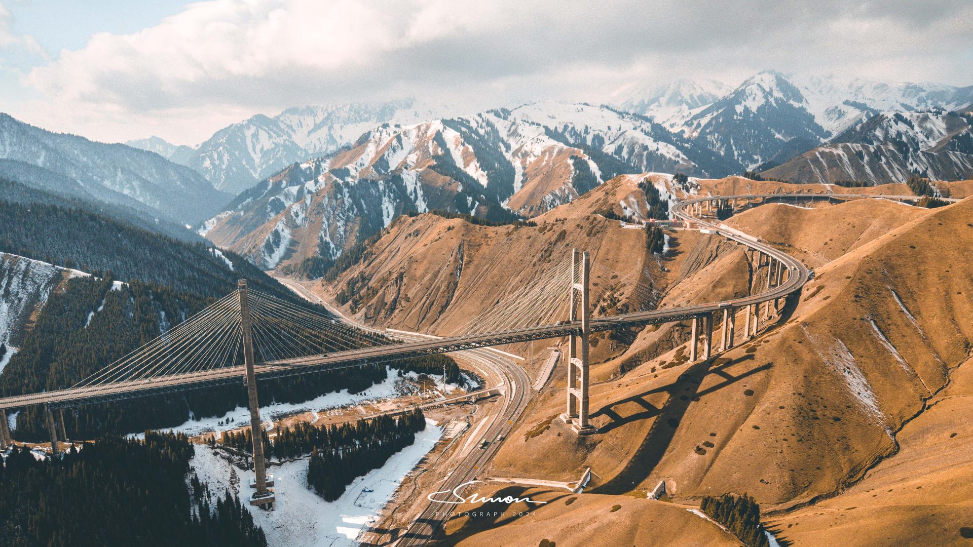
This Guozigou Bridge, located in Huocheng County, Ili Kazakh Autonomous Prefecture, is not only a shining pearl on the Lianyungang-Horgos Expressway, but also a milestone in the history of Xinjiang's transportation construction. The Guozigou Bridge marks a breakthrough in Xinjiang's transportation, connecting the north and south and opening up a passage between Xinjiang and the outside world.
When the drone flew over the bridge, this 700-meter-long steel truss bridge, spanning the Guozigou Canyon, was fully displayed before us. The bridge deck is 200 meters above the valley floor, like a giant dragon suspended between heaven and earth, standing majestically, becoming a symbol of this desolate and vast land.
Sayram Lake
After leaving Guozigou Bridge, we continued to drive to Sayram Lake, a beautiful lake known as "the last tear of the Atlantic Ocean," located in the northern Tianshan Mountains within Bole City, Bortala Mongol Autonomous Prefecture, Xinjiang.
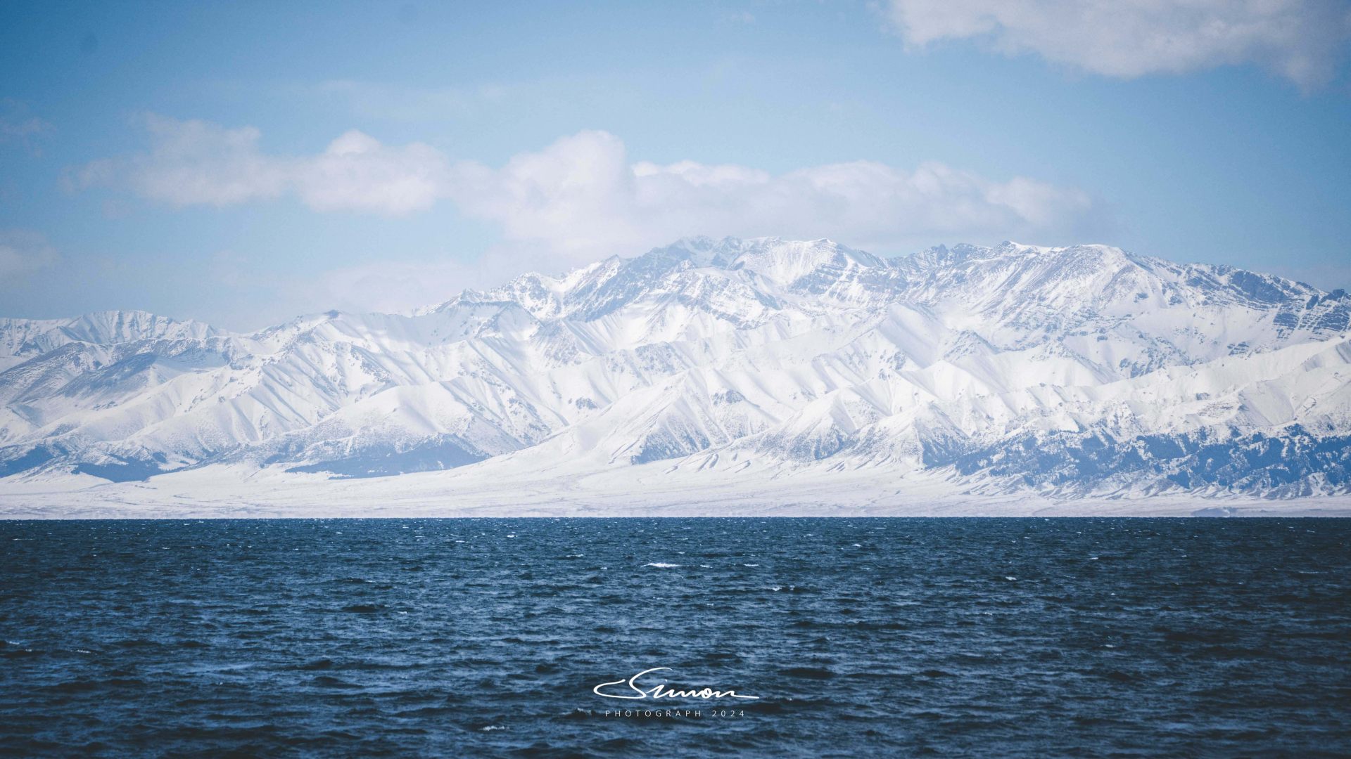
Driving on the scenic road of Sayram Lake, a magnificent scene gradually unfolded before our eyes: on one side were majestic snow-capped mountains, and on the other side was a turquoise lake, as if two extreme beauties of heaven and earth converged here. The lake water of Sayram Lake is clear and transparent, and the tranquil lake surface is like a huge mirror, reflecting the surrounding snow-capped mountains, white clouds, and blue sky, creating a picturesque landscape.
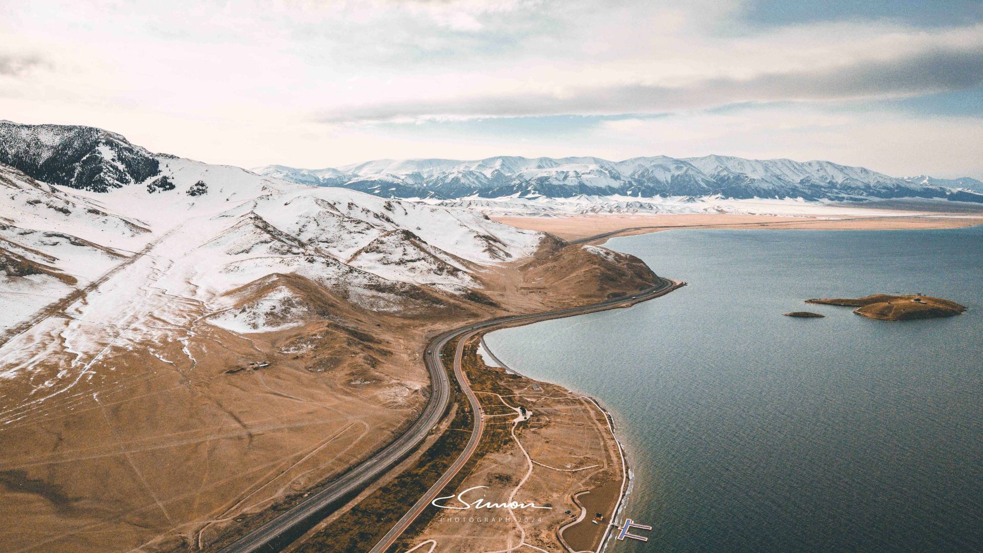
Sayram Lake is not only the highest and largest alpine cold-water lake in Xinjiang, but also the last stop for warm and humid air currents from the Atlantic Ocean, thus its unique geographical location gives it distinctive climatic characteristics and natural landscapes.
The name of the lake, "Sayram," comes from the Kazakh language, meaning "a blessing for travelers on the Silk Road," an implication closely related to the historical origins of this mysterious lake. In addition, Sayram Lake is also known as "Santai Haizi," a name derived from the Santai on the east bank of the lake, which were the garrisons of the Qing Dynasty's Elezhu Yituobomu army. History enthusiasts can also find something here.
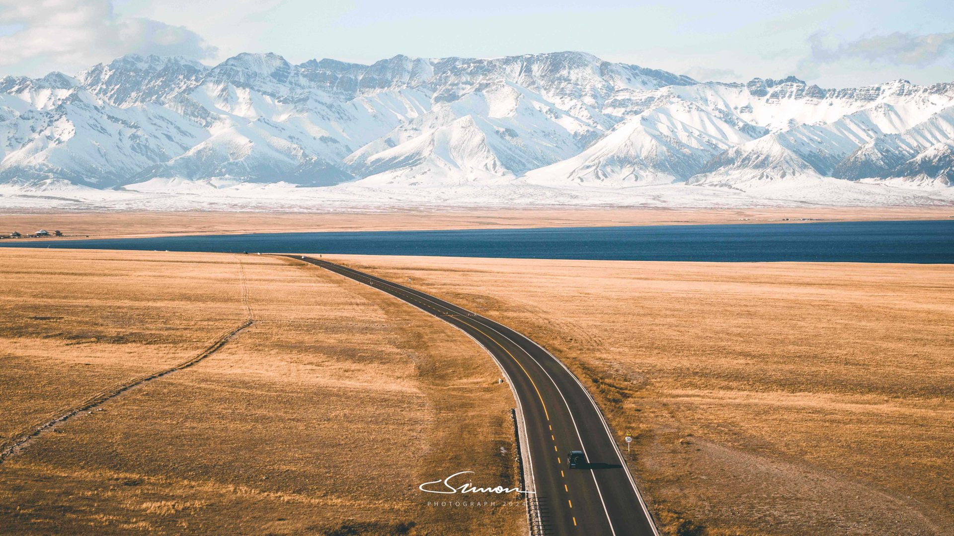
Self-driving on the scenic highway, we felt refreshed and exhilarated. As the scenery outside the car window constantly changed, the vast grasslands (though already barren) and majestic mountains complemented each other, like a vivid painting.
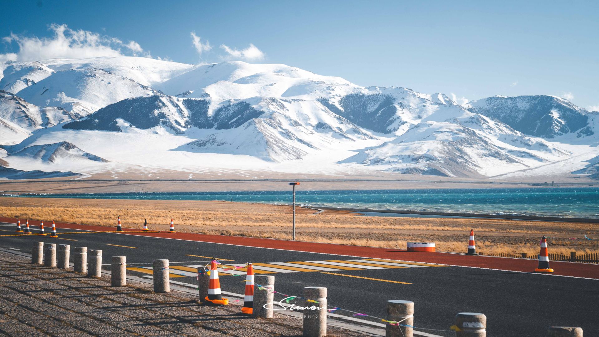
The scenic road allows parking at any time, which enabled us to stop and admire every beautiful scene. We didn't miss any moment, whether it was the ripples on the lake or the clouds swirling around the snow-capped peaks. Along the way, we stopped and went as we pleased, enjoying the gifts of nature.
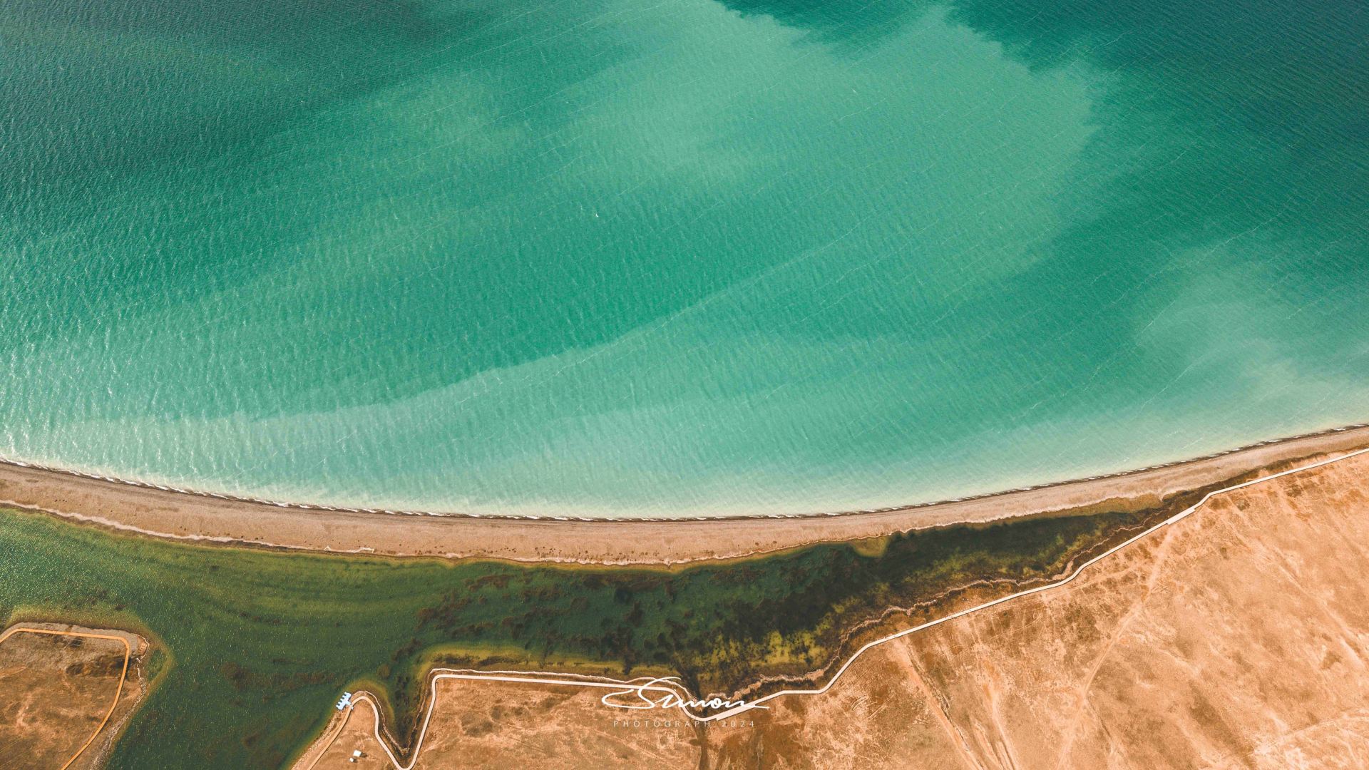
In a sparsely populated place like Xinjiang, having a drone can unlock more beautiful scenery. From a drone's perspective, Sayram Lake's water appears a captivating turquoise, like an emerald embedded in the earth. The lake water is crystal clear, and the gently rippling surface reflects specks of light under the sun, like scattered silver on the lake.
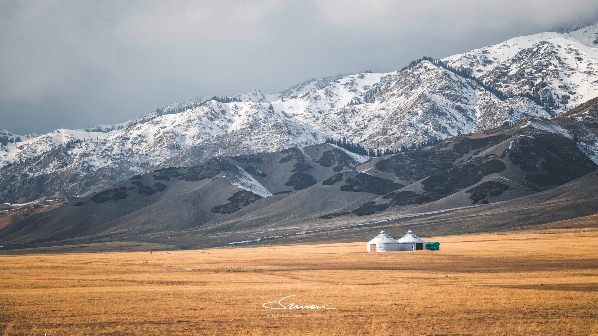
Because it was the off-season, there were very few tourists along the way, and the tranquil atmosphere made this place appear even more primitive and pure. I really like this kind of travel feeling: the parking lots at rest stops were often empty, and many shops were closed. This was perfect for us, who just wanted to enjoy the scenery, as if the entire Sayram Lake belonged only to us.
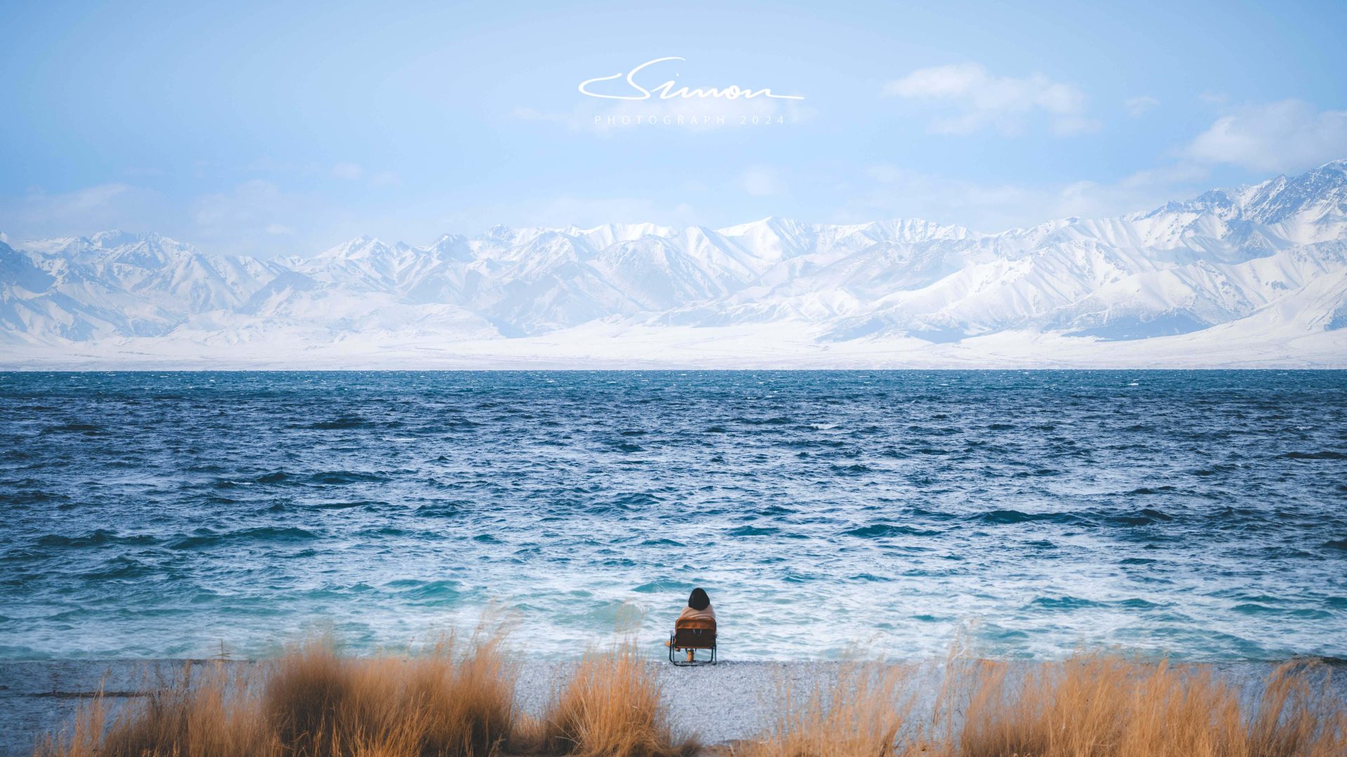
There were no crowds, no noisy sounds, only the sounds of nature. The howling wind and the gentle lapping of the lake against the shore created the perfect white noise, forming the most beautiful natural symphony at this moment. In such an environment, we could completely relax and immerse ourselves in this moment, enjoying intimate contact with nature.
Off-roading! Ghost City
If you want to see Yardang landforms in Xinjiang, you must mention Ghost City. There are actually several Ghost Cities, but the most famous one is the "Karamay World Ghost City Scenic Area" introduced here.
When doing research, I saw many posts about avoiding this scenic spot, and it felt troublesome to take the scenic shuttle bus with all our equipment, so we finally chose to buy self-driving tickets at a small gate next to the scenic area. This way, we could enjoy the Yardang landforms while driving, and also use the drone's aerial view to overlook the entire Ghost City scenic area.
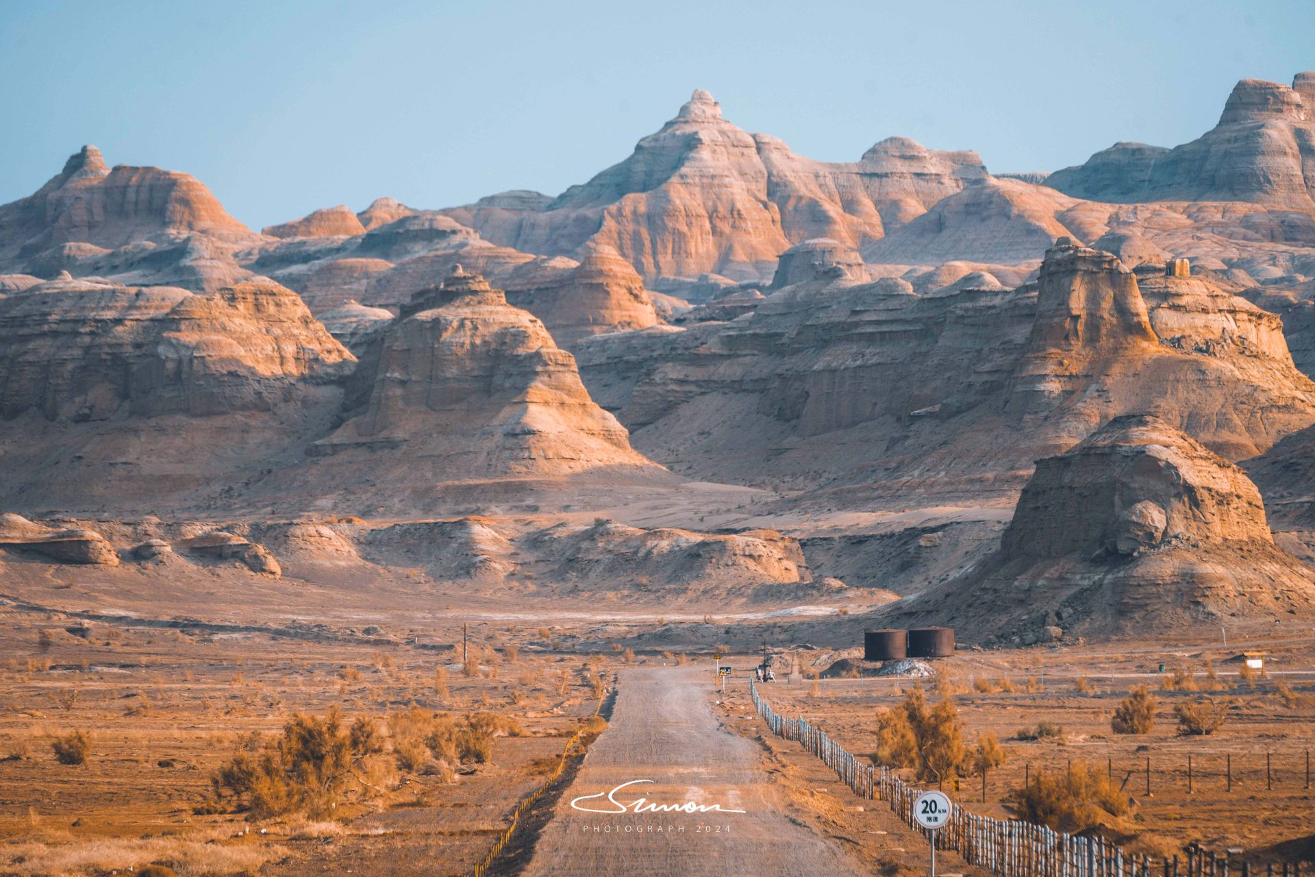
The "Ghost City Self-driving" scenic area and the "Karamay World Ghost City Scenic Area" are not connected. The entire self-driving route is a gravel road, and it takes about 40 minutes to complete if you don't stop. However, once you drive in, the scenery gradually changes from a Gobi desert to strangely shaped Yardang landforms, and you can't help but gradually immerse yourself in it.
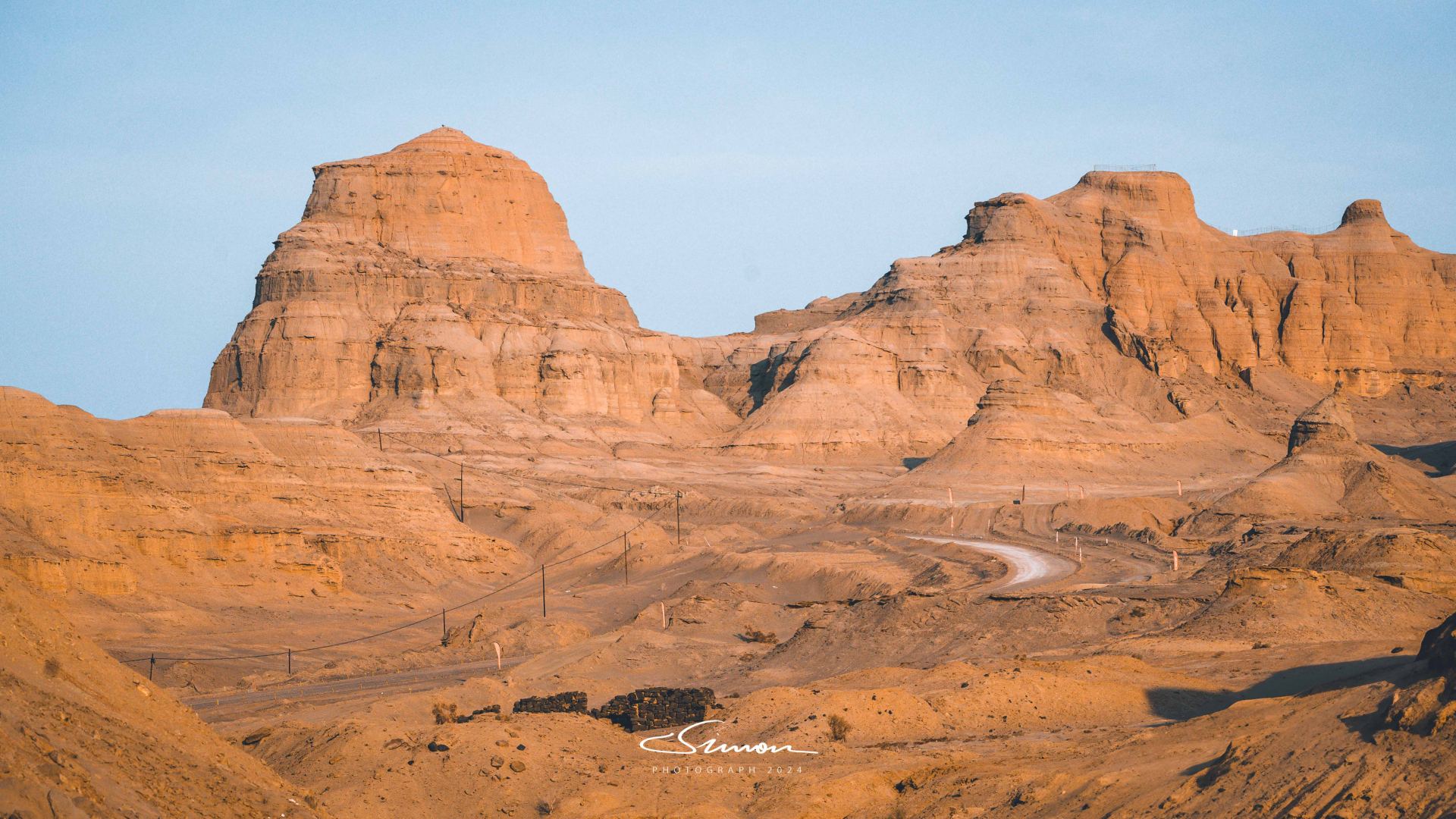
Although the self-driving route in Ghost City is not long, precisely because there are few tourists, the unique charm of this desolate land appears exceptionally pure. On this journey, we hardly encountered any other vehicles, so we could gallop freely in the desert. Driving on quiet, uninhabited roads, the peculiar Yardang landforms and magnificent natural landscapes became the best photographic backdrops, and the photos taken felt like they were on "Mars."
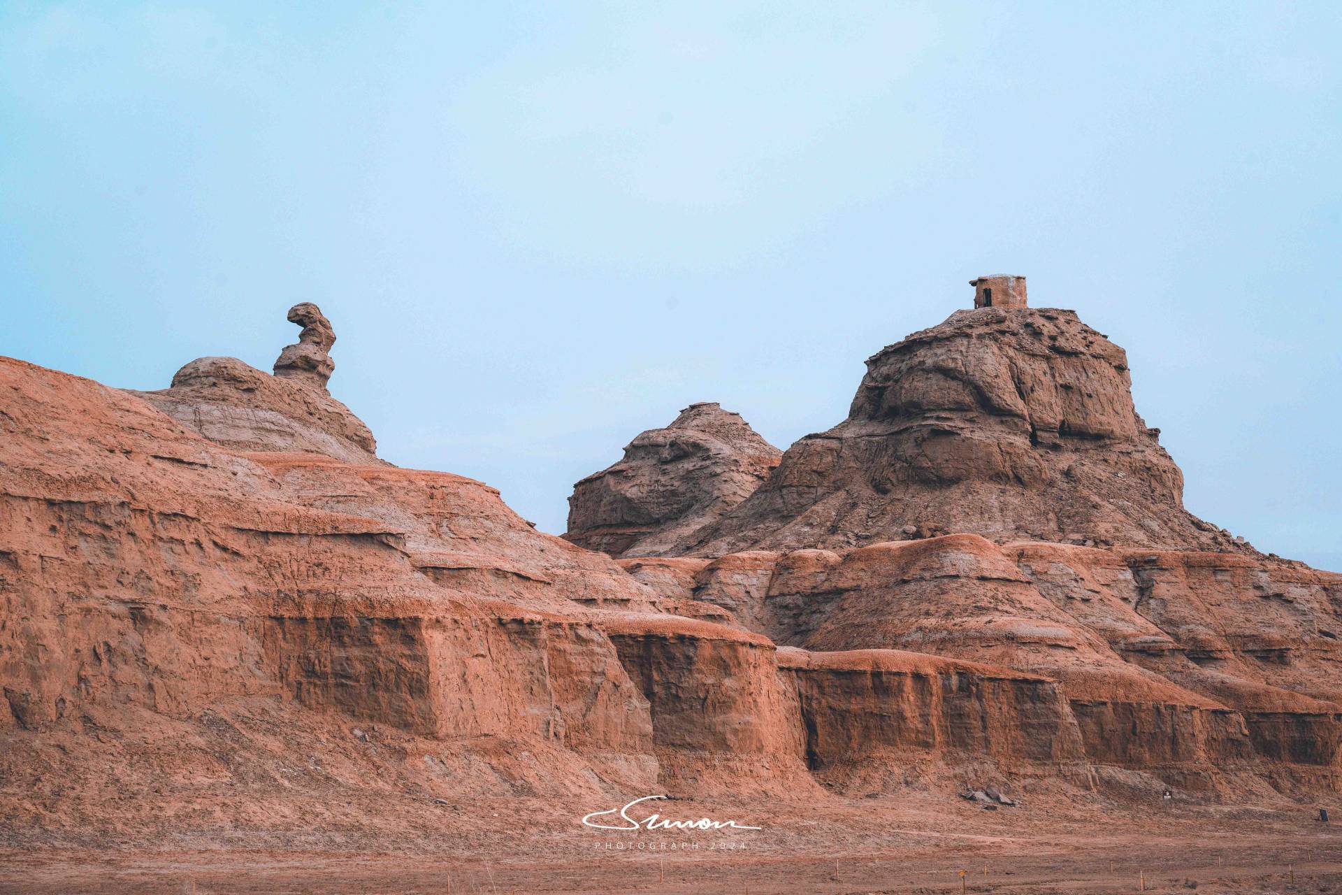
If you visit here completely, you will understand why most of these Yardang landform scenic spots are "mixed in reputation." The Yardang landforms are carved like knives and axes, with various shapes, and whether they are "beautiful" or not depends entirely on personal imagination: for example, the stone in the picture above is called "ET Alien," can you find which part looks like an alien?
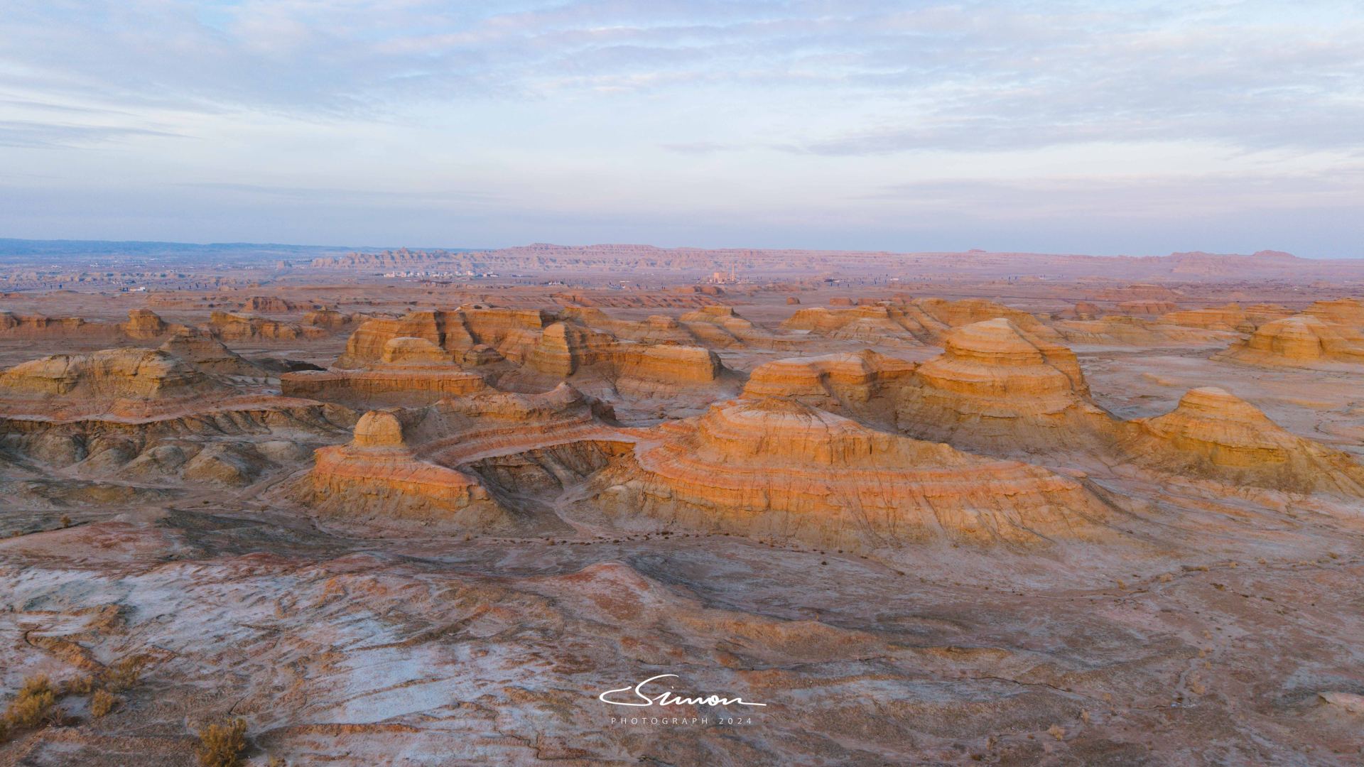
We entered the scenic area at noon, stopping and going, and only left after sunset. For us, the Yardang landforms at sunset were undoubtedly the most beautiful: when the setting sun shone on the Yardang landforms, overlooking this area from a drone's aerial perspective, the undulations of the rocks and the intertwining shadows made the entire land appear uneven. The winding gullies, like the veins of the earth, divided the Ghost City's landforms into countless rock formations and hills of various shapes.
Traversing! Ahe Highway
Note: Winter weather is complex and changeable. Traversing the Ahe Highway requires driving a four-wheel-drive off-road vehicle equipped with snow tires. Drivers should have certain experience in driving on icy and snowy roads, check vehicle conditions in time, and keep the vehicle in good condition --- quoted from the official "Notice on Winter Opening of Ahe Highway"
Ahe Highway, as its name suggests, is a highway connecting Altay and Hemu, which just opened for trial operation in September this year, with a total length of 209 kilometers. After its opening, the journey from Altay City to Hemu Scenic Area has been greatly shortened from the previous 6 hours to 3 hours. Since this highway runs through the mountains, connecting various landscapes such as Gobi, canyons, forests, rivers, wetlands, snow-capped mountains, grasslands, and stone forests along the way, it is expected to become the next "internet-famous highway."
Because it was a newly opened route in autumn this year, there were few guides for traversing the Ahe Highway in winter. In addition, it had snowed heavily for several days before our arrival, and the news we saw online was all about the road being closed in winter, so we were very apprehensive before setting off. Fortunately, we just caught the reopening of the Ahe Highway and became one of the few vehicles passing through that day (we didn't encounter any other cars throughout the journey).
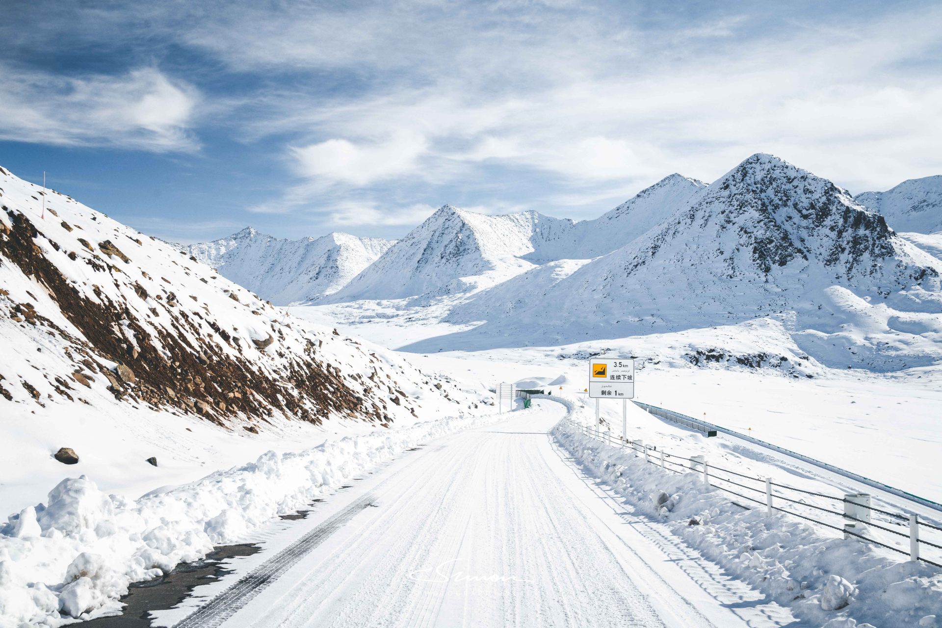
As the vehicle drove onto the highway, the scenery in front of us rapidly changed, as if entering a completely different world. All around were majestic snow-capped mountains, and the forests and grasslands in the mountains were covered with thick snow. Snowflakes occasionally drifted in the air, and the air was so fresh that it was intoxicating.
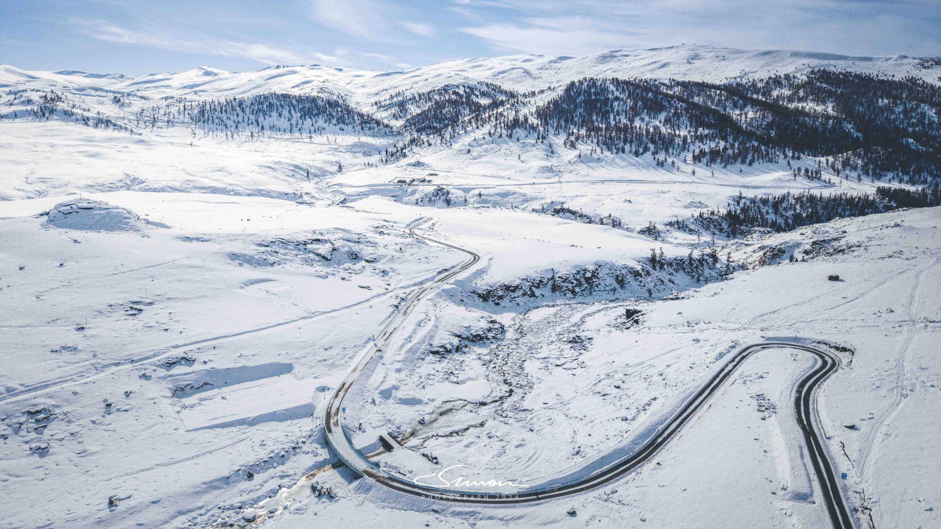
Traversing the Ahe Highway is like a ribbon cutting through nature: connecting various landforms such as canyons, forests, rivers, and wetlands, and with every turn, a different scene unfolds before your eyes.
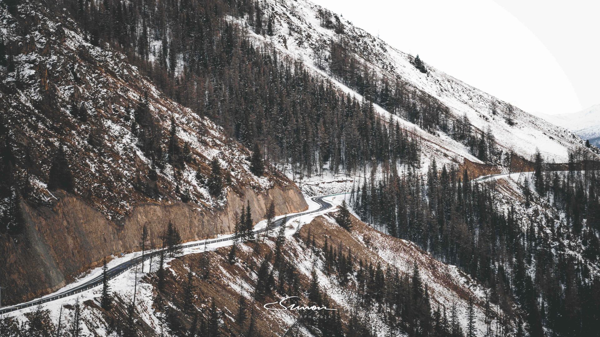
The snow-capped mountains along the way stand like huge white screens in the distance; in the forests at the foot of the mountains, the branches of the trees are covered with snow, like exquisite paintings; in the canyons, cold streams rush down, and the water surface is covered with snow, appearing quiet and deep.
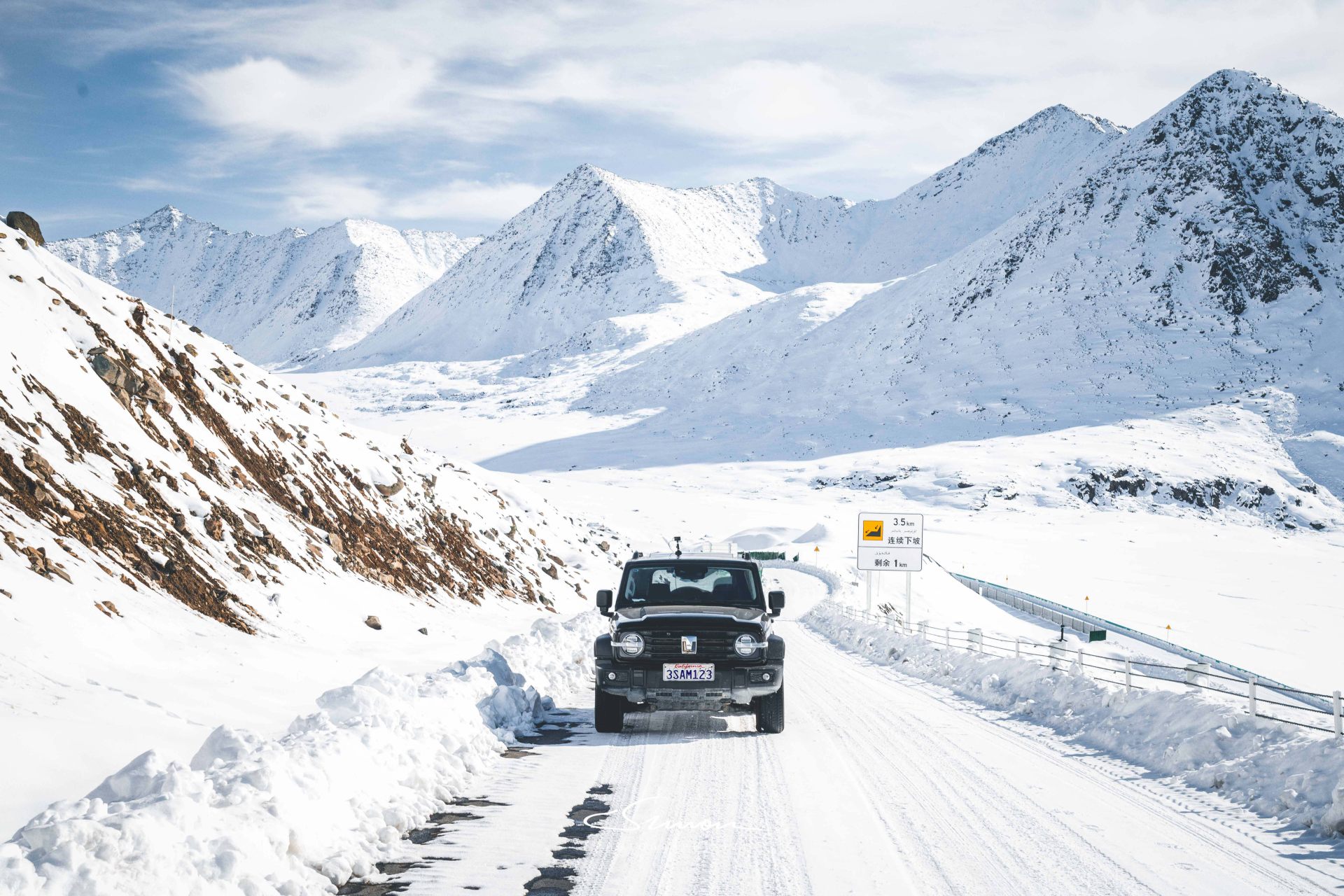
Although the winter traverse of the Ahe Highway offers beautiful scenery, it also carries certain risks. At least one-third of the highway is covered with snow. While the snow scenery is as pure as a fairy tale, the icy surface after the snow melts makes the road slippery, requiring extra caution when driving.
In addition, most restrooms are locked in winter, and there are no places for shopping or refueling along the way, and mobile phone signals are not fully covered. Therefore, it is necessary to prepare sufficient supplies before entering the Ahe Highway.
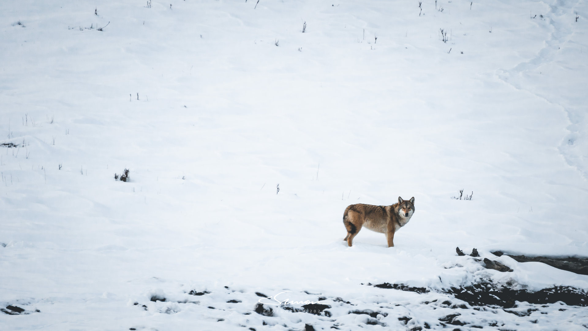
In the latter part of traversing the Ahe Highway, we encountered wild lone wolves multiple times. At first, I thought they were herders' dogs frolicking in the snow (because I had seen many dogs before), but after careful observation, I realized they were real wolves. I, who was taking photos outside the car, quickly got back into the car for "emergency shelter."
However, after a wary stare at us, the wild wolves turned and disappeared into the vast snowy wilderness. Although it was a bit thrilling, no accidents occurred. Instead, this brief moment made people truly feel the wild beauty of this primitive land and the subtle balance between humans and nature.
Kanas National Geological Park
Hemu Village
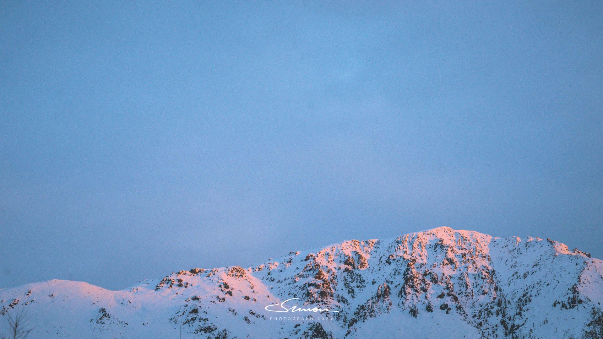
In the early morning, when the first ray of sunlight quietly crossed the mountain top and shone on the distant snow-capped mountains, that moment seemed to light up the world, and the scene before our eyes became warm and sacred. This is the legendary "Golden Mountain under the Sun," where the white of the snow-capped mountains was instantly painted with golden brilliance, like being draped in a layer of golden satin, shining brightly. The air was crisp, the river gurgled, and the scenery before us was tranquil and magnificent, making us hold our breath, just to savor this painting gifted by nature.
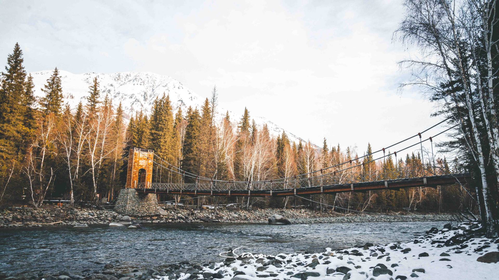
And this aid-Xinjiang bridge spanning the river stands out prominently in this tranquil world. The two ends of the bridge are supported by heavy stone foundations, and the bridge body is built with wooden planks and steel cables, which is both sturdy and full of rustic beauty. The lines of the bridge appear soft in the morning sun, complementing the golden snow-capped mountains in the background and the towering birch forests on both banks, as if telling the moving story of aid to Xinjiang in those years.
Standing under the bridge, the river is crystal clear, and the winter ice and snow cover the stones on the riverbank, adding a touch of chill to this scenery. Standing on the bridge, feeling the slight sway underfoot and listening to the sound of the water hitting the stones, time seems to stop at this moment, and only this quiet beauty is intoxicating.
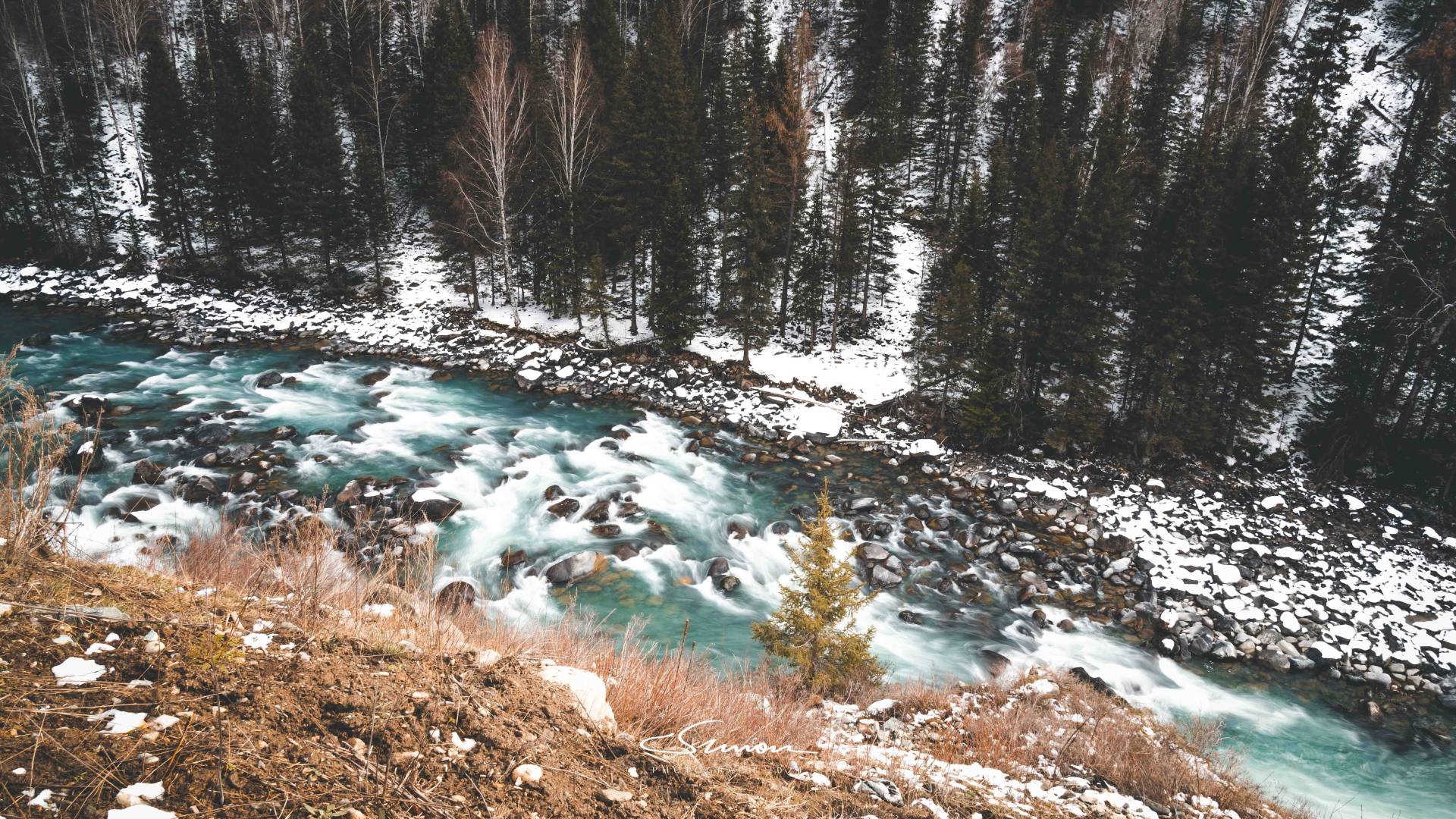
Due to the awkward season we arrived in Hemu: autumn had passed, and there wasn't enough snow in early winter, it was in the melting snow stage, making Hemu relatively dirty. Therefore, the scenery of the Hemu Village itinerary was not as stunning, but the overall scenery of Kanas and the feeling of driving to the border were very good.
Moon Bay, Wolong Bay, Shenxian Bay
Kanas has three bays: Shenxian Bay, Wolong Bay, and Moon Bay. The three bays of Kanas are like a green ribbon winding through the mountains, connecting the grandeur and magic of Kanas, and are one of the unmissable beautiful sights of Kanas.
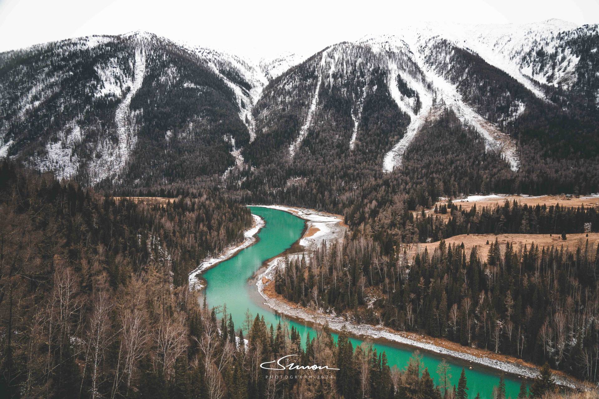
Our first stop was Moon Bay, where legend has it that Chang'e flew to the moon, leaving behind a pair of footprints shaped like a crescent moon, hence the name.
In winter, Moon Bay and its surroundings are like a secluded fairyland. The river winds through the mountains, shaped like a new moon, quietly nestled among the peaks. The mountains on both sides are covered with snow, and the ancient trees in the forest are draped in thick white veils, as if the whole world has entered a tranquil and pure dream.
Moon Bay, nestled between the east and west mountains, has become an unmissable stop in Kanas due to its unique river shape and the tranquil beauty of winter. When we arrived, a thin layer of ice had formed on the surface of the river, reflecting a magical blue-green color under the sunlight, forming a strong contrast with the surrounding snow-white forest. The flowing river under the ice made a faint gurgling sound, blending with the surrounding silence, making people feel peaceful.
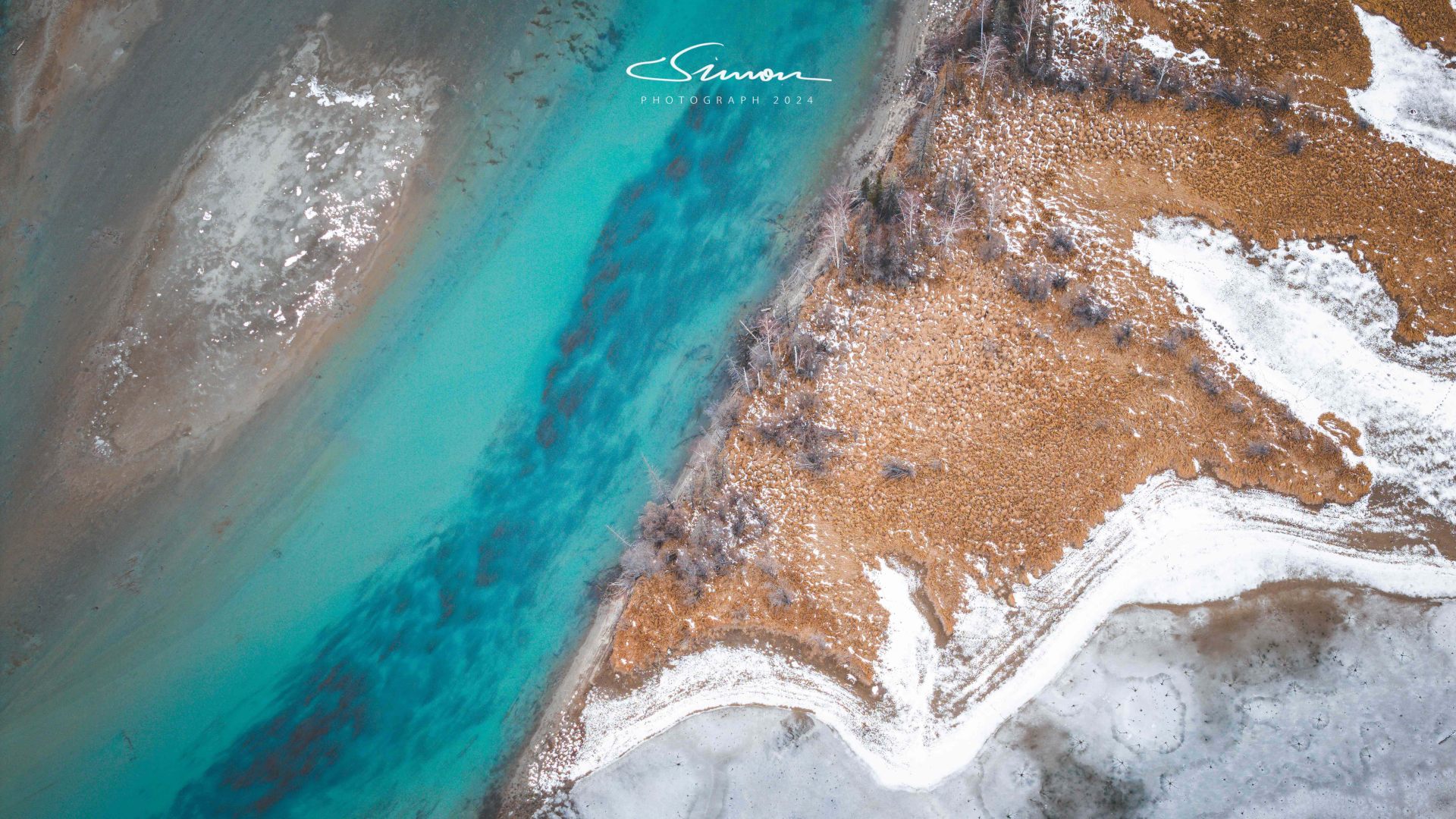
Our second stop was Wolong Bay. From a drone's high-altitude view of Wolong Bay in winter, the entire scene is like a painting frozen in time. The river winds through the pristine forest covered with white snow, like a blue jade belt on a white land. The bay is named after its shape resembling a giant reclining dragon, and from the drone's perspective, this "giant dragon" appears exceptionally vivid, as if sleeping in the vast snowy wilderness, waiting for spring to awaken it.
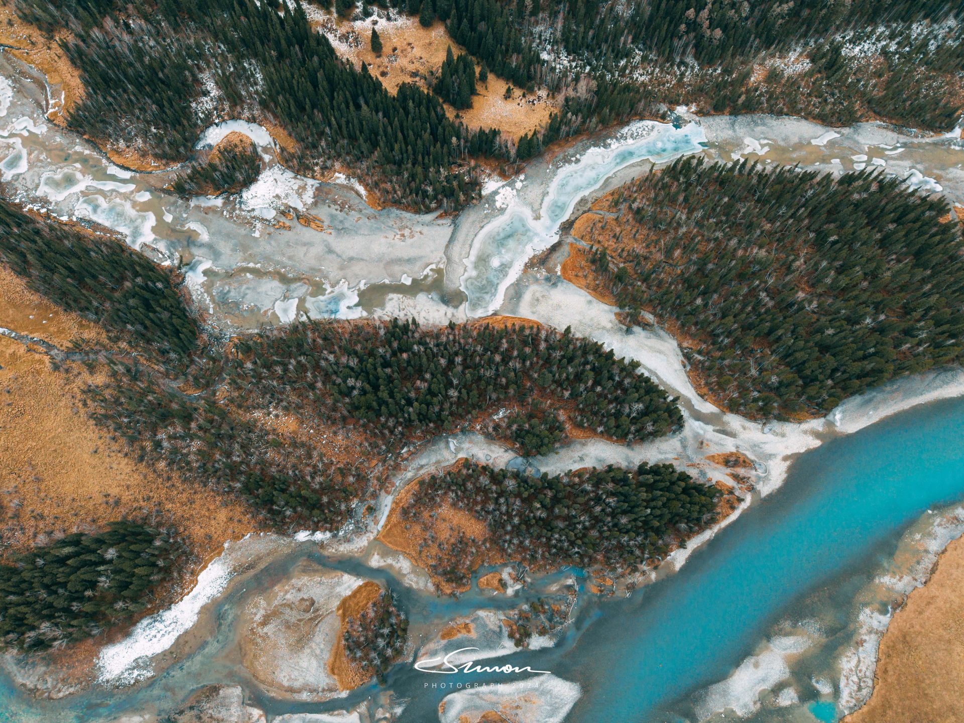
Walking along the wooden boardwalk, you can reach the observation deck and overlook the entire Shenxian Bay from above. At this time, the bay area is surrounded by white snow, and the river is not completely frozen, flowing like a ribbon through the jungle, while a layer of white snow still remains on the grasslands on both sides of the river. All of this is like a meticulously painted winter scroll, making people linger.
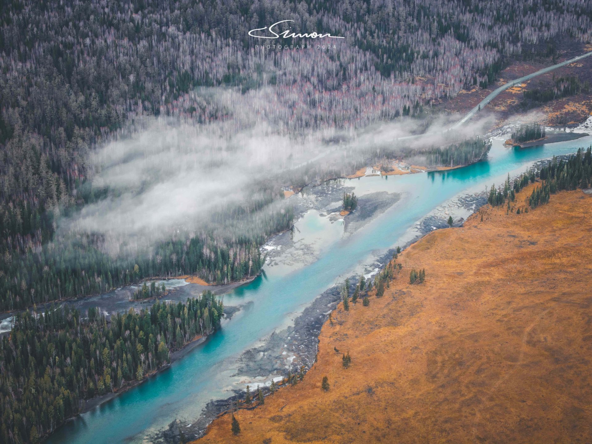
Whether it's the misty morning or the dazzling sunlight on the bay in the afternoon, every moment of Shenxian Bay is full of poetry and vitality. Because Shenxian Bay under the morning mist is exceptionally beautiful but hard to come by, Shenxian Bay in winter is definitely a paradise for photography enthusiasts. The tranquility and beauty here can also make people forget the hustle and bustle of the world, and just want to quietly feel this gift of nature.
Kanas Lake and Bahaiba Village
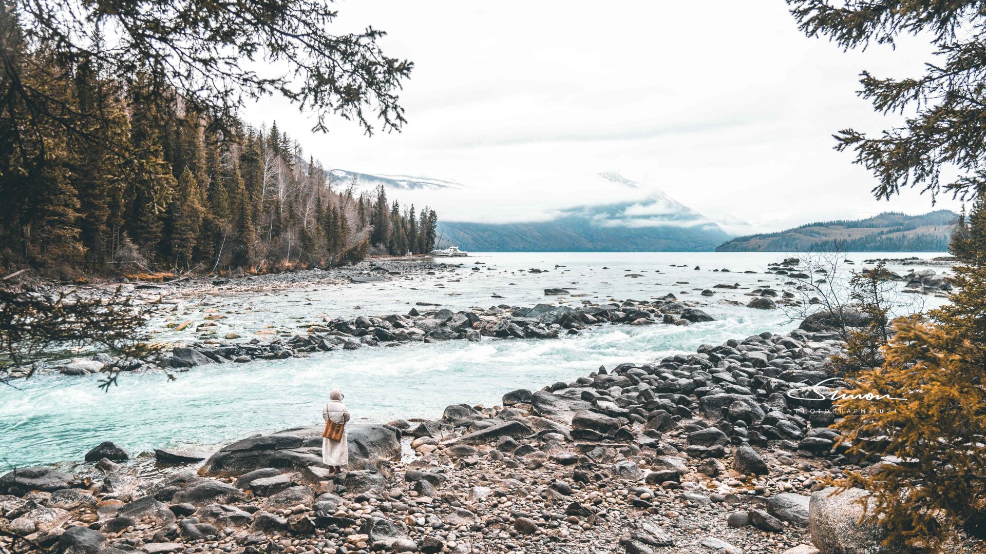
Following the three bends straight up, through the snowfields and dense forests, Kanas Lake appears before your eyes. This tranquil alpine lake is like a dazzling pearl embedded deep in the Altai Mountains, with clear blue water, surrounded by majestic snow-capped peaks and dense forests, creating a breathtakingly beautiful scene.
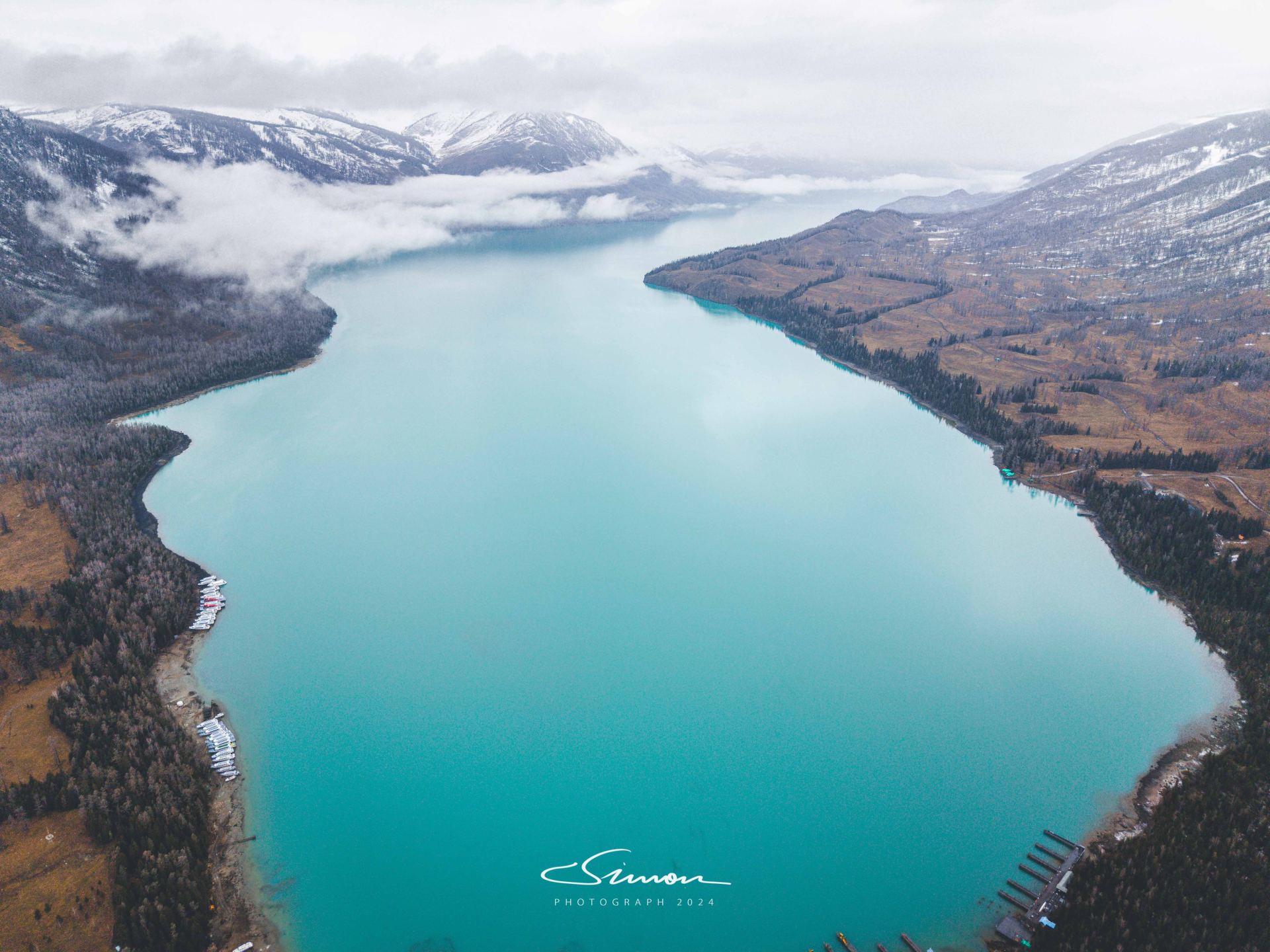
Kanas Lake has an altitude of 1374 meters and a lake area of 45.73 square kilometers. It is the deepest moraine-dammed lake in China, with a maximum depth of 188.5 meters. In winter, Kanas Lake is covered with a thick layer of ice, and the lake surface is like a huge silver mirror, reflecting a faint light under the sun. The distant snow-capped mountains are even more magnificent against the blue sky, and the pine forests in the mountains are decorated with ice and snow, crystal clear, presenting a solemn and tranquil scene in the entire lake area.
The surrounding attractions of Kanas Lake are also worth visiting: bidding farewell to the beautiful scenery of Kanas Lake, we drove along the winding mountain road towards Bahaiba Village in the northwest. The wheels rolled over the snow-covered road, gradually approaching this ancient village known as "the first village in the northwest." As the mountains undulated, distant wooden houses and mountain mist appeared in sight, and the unique and tranquil atmosphere of Bahaiba Village quietly welcomed our arrival.
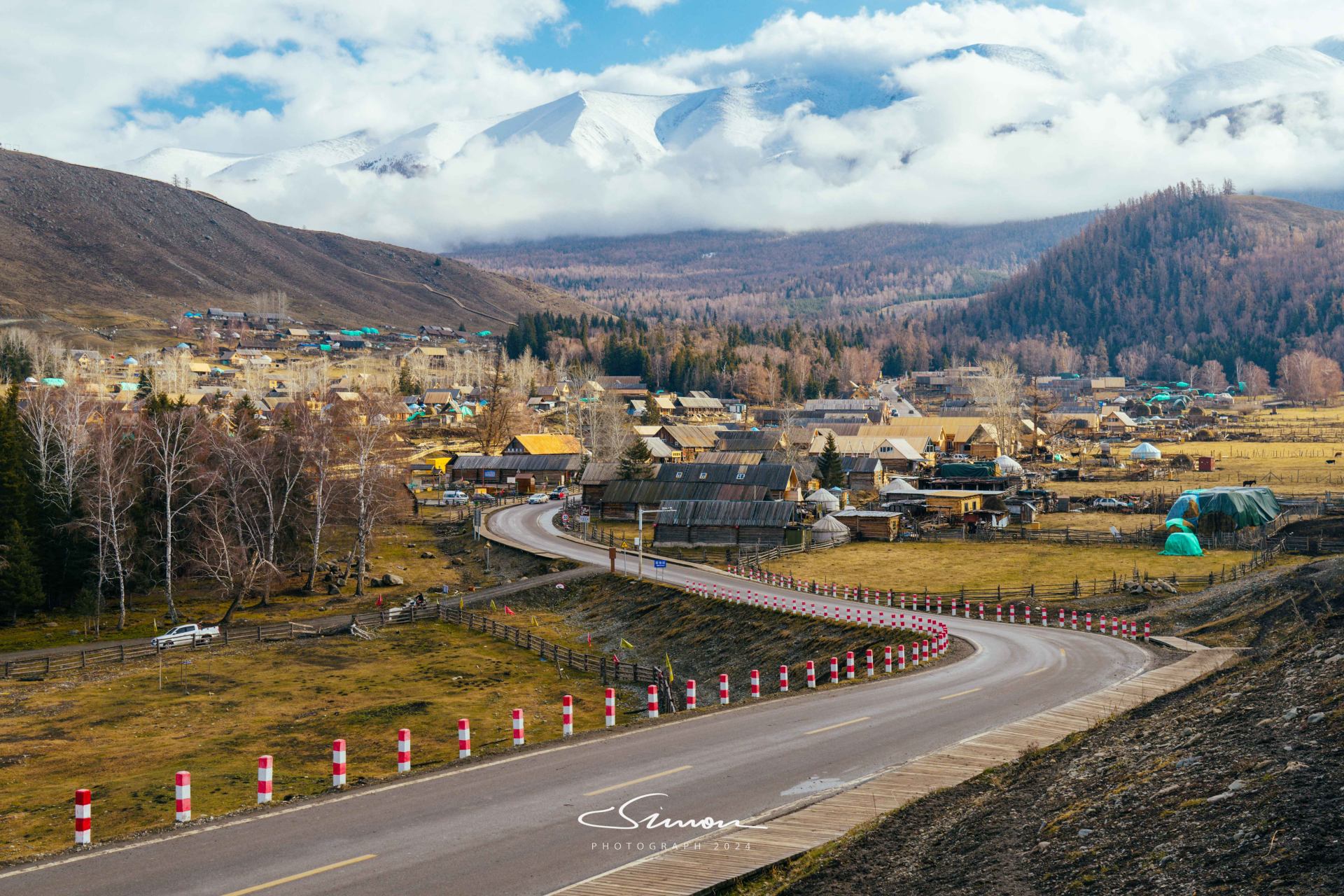
Bahaiba Village, located at the northwesternmost corner of China's map, at the foot of the Altai Mountains, borders Kazakhstan and is known as "the first village in the northwest" and "the first outpost in the northwest." This remote and tranquil small village is like a pearl lost in the human world, surrounded by dense forests and clear streams, exuding a primitive and charming atmosphere.
The scenery here is like a fairy tale world. Large areas of birch and pine forests undulate with the mountains. In winter, they are covered with white snow, appearing pure and mysterious. Small streams flow slowly through the forests, with clear water reflecting the sky and trees, as if adding a natural mirror to this land. The wooden houses scattered in the village, though seemingly simple, reveal an ancient charm. These "log cabins" built by the Tuvans with logs appear exceptionally warm in winter.
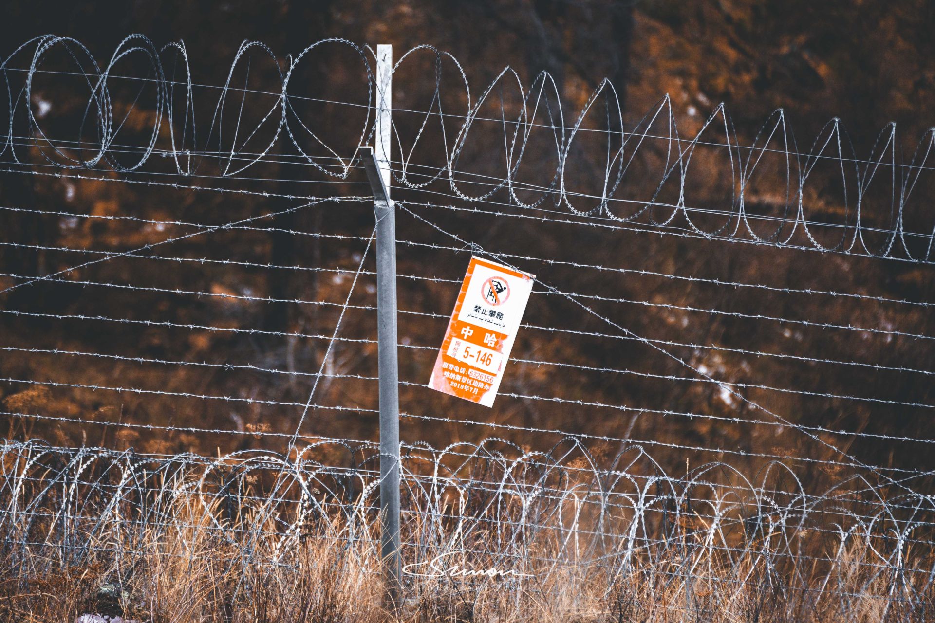
Starting from Bahaiba Village, along the winding cliff road, we headed towards the China-Kazakhstan Border Grand Canyon. It took about an hour's drive, and the road was not smooth, but the closer we got to the Grand Canyon, the more we could feel its magnificent atmosphere. Mountains and canyons intertwined, and the Bahaiba River rushed through the deep canyon. The clear river water shimmered in the sun, as if telling the story of this land.
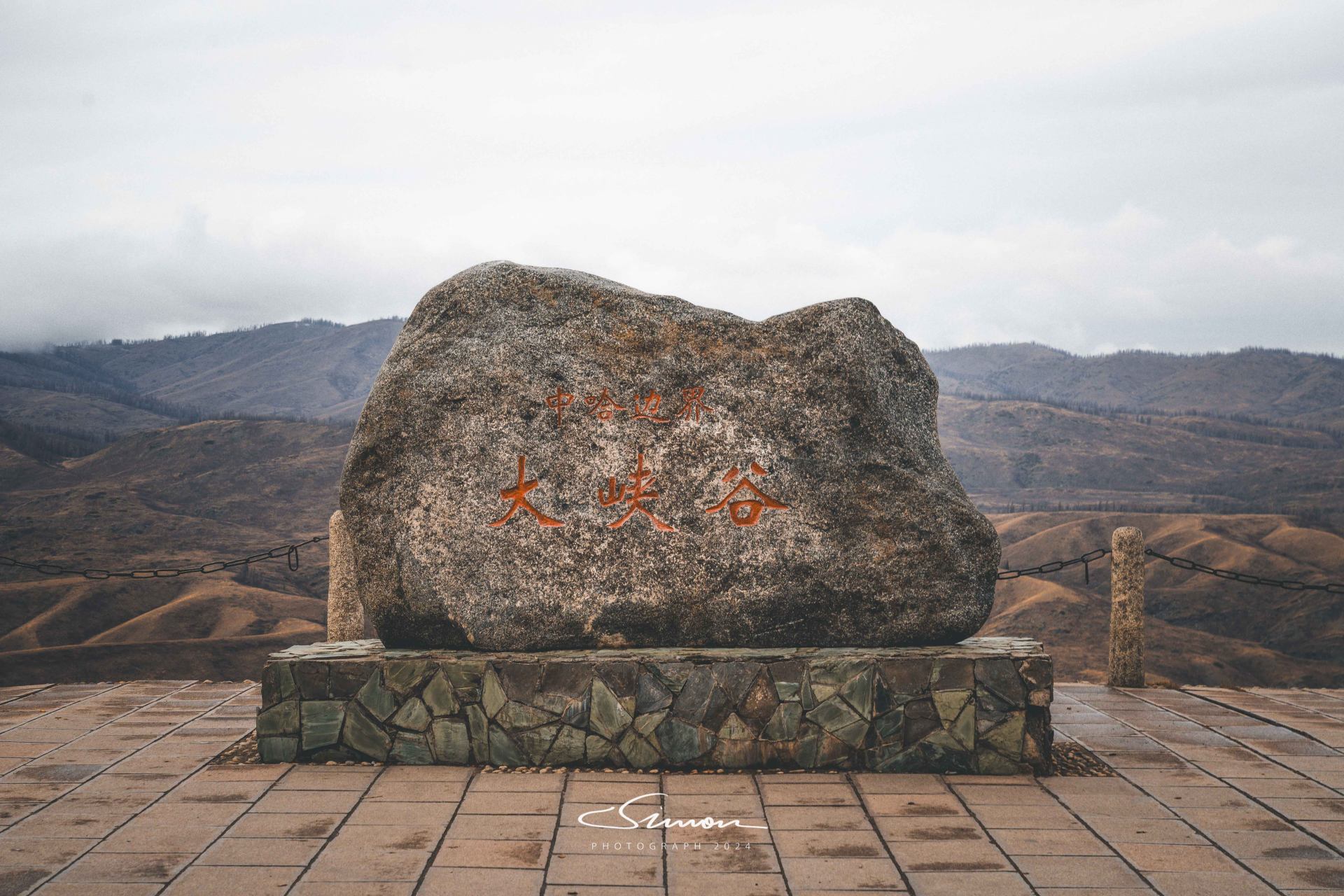
The China-Kazakhstan Border Grand Canyon, also known as the Tieleyeketi Grand Canyon, is a section of the Bahaiba River Valley, which forms the border between China and Kazakhstan. This is the quietest yet most breathtaking place on the border. On both banks of the wide and deep canyon, birch forests and pine trees complement each other, and the sound of the Bahaiba River flowing through the canyon echoes, seemingly a symphony of nature. The floating deadwood in the river, scattered on both banks, adds a strange and ancient beauty to this land.
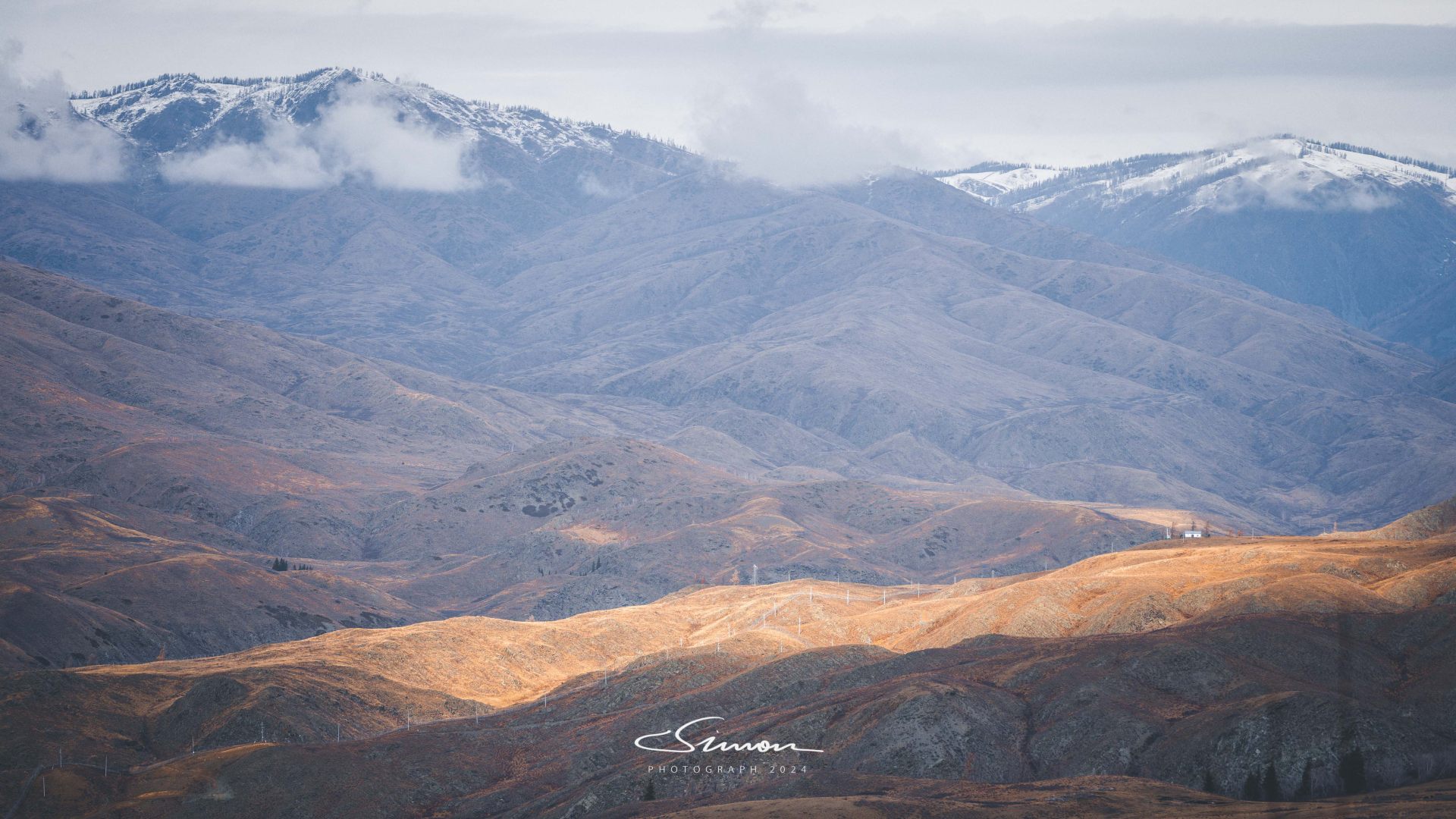
Overlooking from the observation deck, the end of the river valley is the border of Kazakhstan. With the valley as the boundary and the river as the line, the clearly visible iron fence on the river bank separates the two countries. On the opposite bank are the vast and sparsely populated mountains and grasslands of Kazakhstan, with large areas of land still barren, appearing empty and primitive. On our side, there is a dense birch forest and vibrant grassland, where cattle and sheep leisurely graze, blending with the surrounding natural landscape.
The China-Kazakhstan Border Grand Canyon is not only a natural wonder but also a symbol of national identity, making people deeply feel the grandeur and solemnity of the motherland's frontier.
S21 Desert Highway
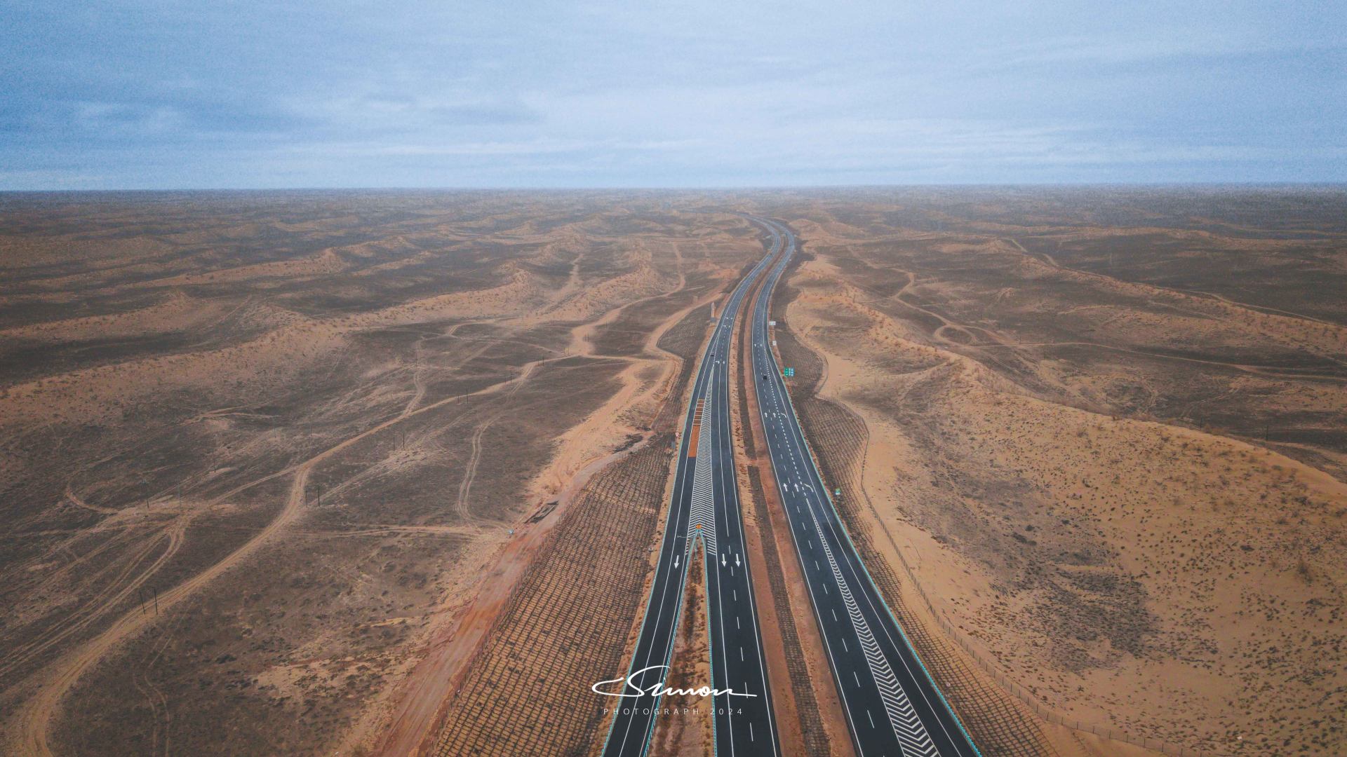
To return to Urumqi from the Altay region, the S21 Desert Highway is a highly recommended route. The S21 Desert Highway forms a north-south expressway corridor starting from the Altai Mountains and ending at the Altun Mountains, with a total length of 342.538 kilometers. The completion of this road has shortened the journey from Urumqi to Altay City to about 4 hours, without the need for detours, allowing for "direct high-speed access."
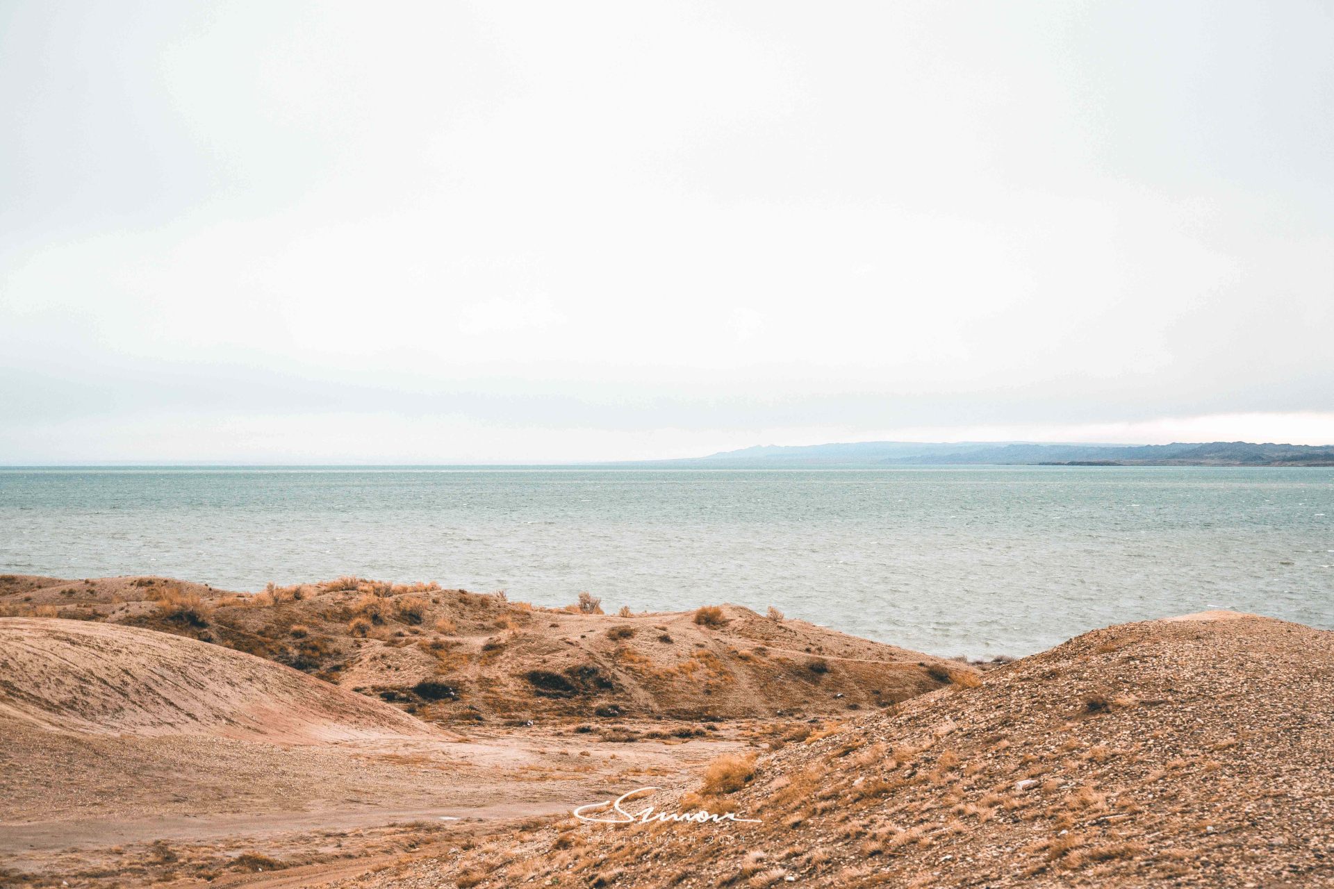
This highway traverses China's second-largest desert, the Gurbantünggüt Desert, and the hinterland of the Junggar Basin, so the landforms along the way are relatively rich. At the entrance to Altay, you will pass by Ulungur Lake, a relatively niche attraction. Friends who are not in a hurry to return (to Urumqi) can also stop here to admire this sea-like magnificent lake.
Traversing! Hami Dahaidao
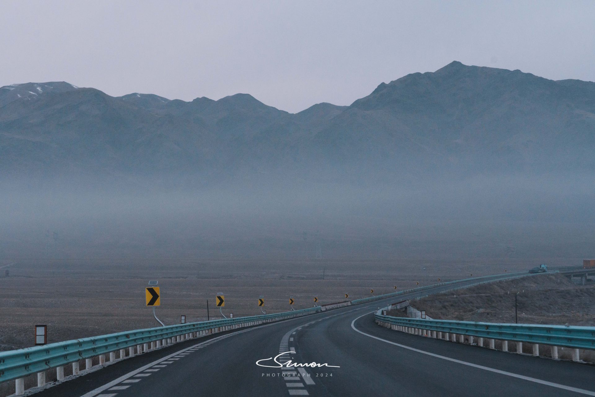
Hami Dahaidao was the last stop of our Northern Xinjiang trip. Although it is located in Hami, it is not on the way for the overall itinerary of either Northern or Southern Xinjiang. However, because we had relatively ample time, before returning to Urumqi and starting our Southern Xinjiang journey, we decided to go to Dahaidao to see this desert wonder known for its grandeur and mystery.
Dahaidao, it is said, was a shortcut to the Western Regions on the ancient Silk Road. It started from Dunhuang, passed through Hami, and finally reached Turpan, connecting the commercial and cultural exchanges between East and West. However, this road was not an ordinary path, but a dangerous route explored by caravans in the Gobi and desert during the Han Dynasty. Along the way, most of it was uninhabited areas, and its desolation and hardship were daunting.
Regarding the origin of the name "Dahaidao," there are various opinions. One theory is that because this road traverses the boundless Gobi like a vast sea, "sea" does not refer to a water sea, but a "sand sea"; another theory is that the Gashun Gobi, which Dahaidao passed through, was called "Dasha Hai" (Great Sand Sea) in the Tang Dynasty, hence the name. Regardless of the explanation, "Dahaidao" gives this desolate land a vast and mysterious imagery.
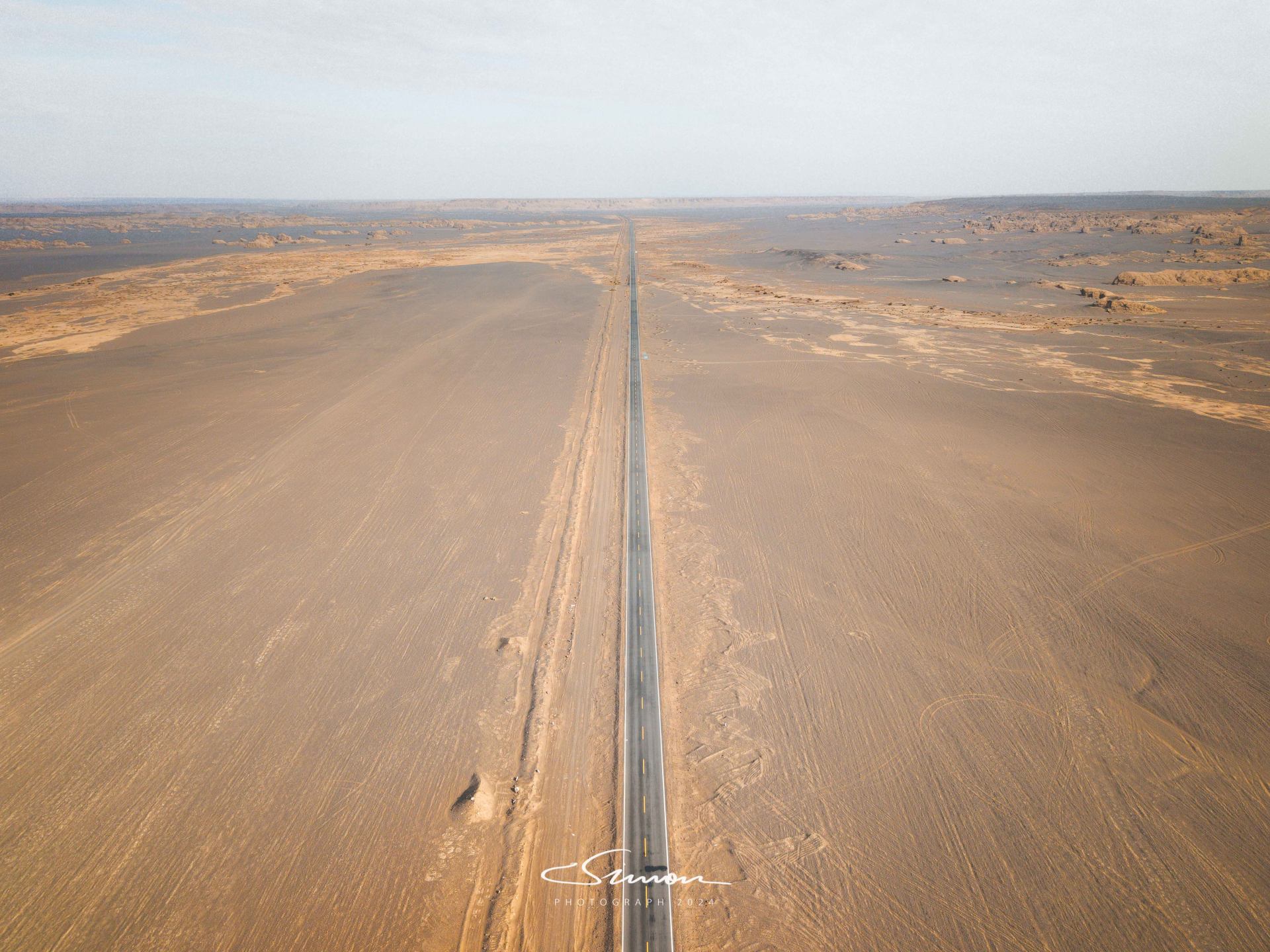
And now, Dahaidao has become a relatively mature scenic spot. Driving from the scenic area entrance, the first dozen kilometers are flat asphalt roads, with continuous Gobi on both sides, like a straight road leading to the unknown.
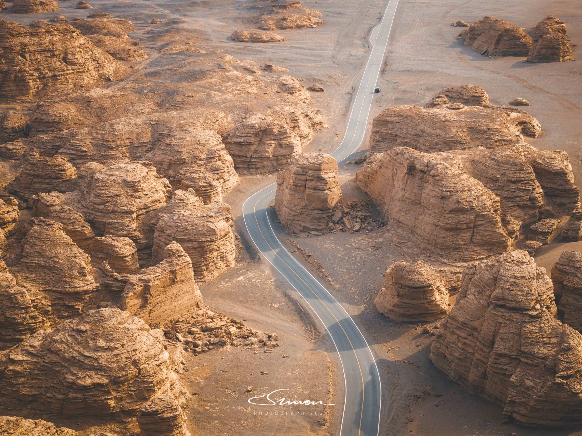
Although the asphalt road section covers most of the attractions in Dahaidao, I believe the essence of traversing Dahaidao is still hidden in the gravel road section. After entering the gravel road, the mobile phone signal completely disappears, and everything can only rely on the tire tracks left in front to guide the direction. Although Dahaidao is now a well-developed scenic spot, the section without signal still poses certain challenges, especially when the vehicle gets stuck or breaks down, which further tests preparation and response capabilities: on the way, we encountered a Tank 300 that had a flat tire and did not carry a jack to change the tire, and there was no signal on the phone to call for help. It would be difficult to walk to the scenic area service area with signal more than ten kilometers away. Fortunately, our tools were just right, and the car was able to return safely.
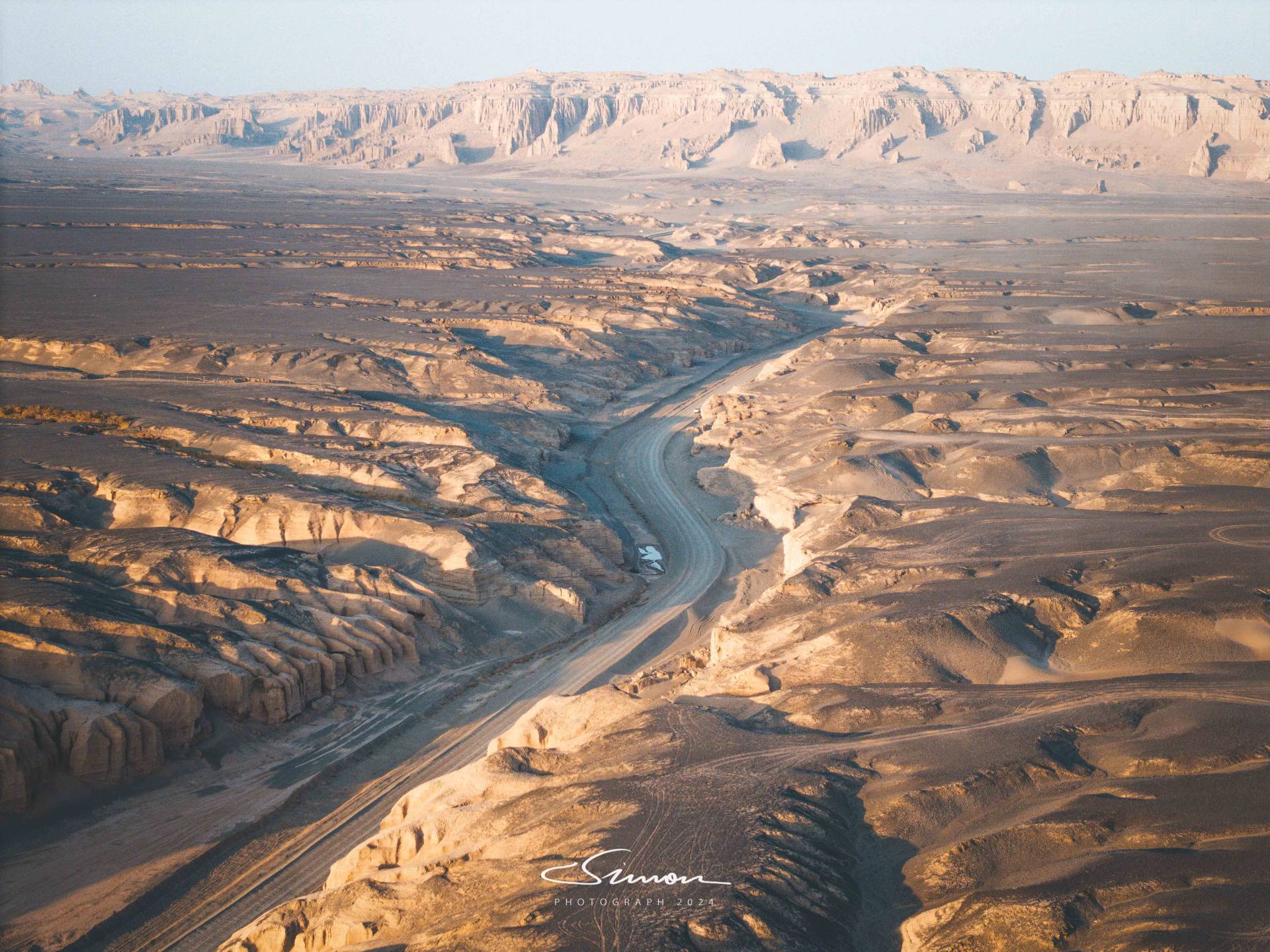
After driving past the asphalt road section, the scenery suddenly changed, and the vehicle entered the unpaved gravel road section, with the breath of the desert coming to us. The wheels rolled over the fine gravel and sand, raising a faint dust, forming long, thin lines of light under the sun. The vehicle sometimes slipped slightly in the soft sand, and sometimes made a crisp collision sound on the gravel road, requiring extra concentration at every moment while holding the steering wheel. As the road undulated, the view became wider, and the distant Yardang landforms gradually appeared, with various shapes of mounds and mountains like natural sculptures on the earth.
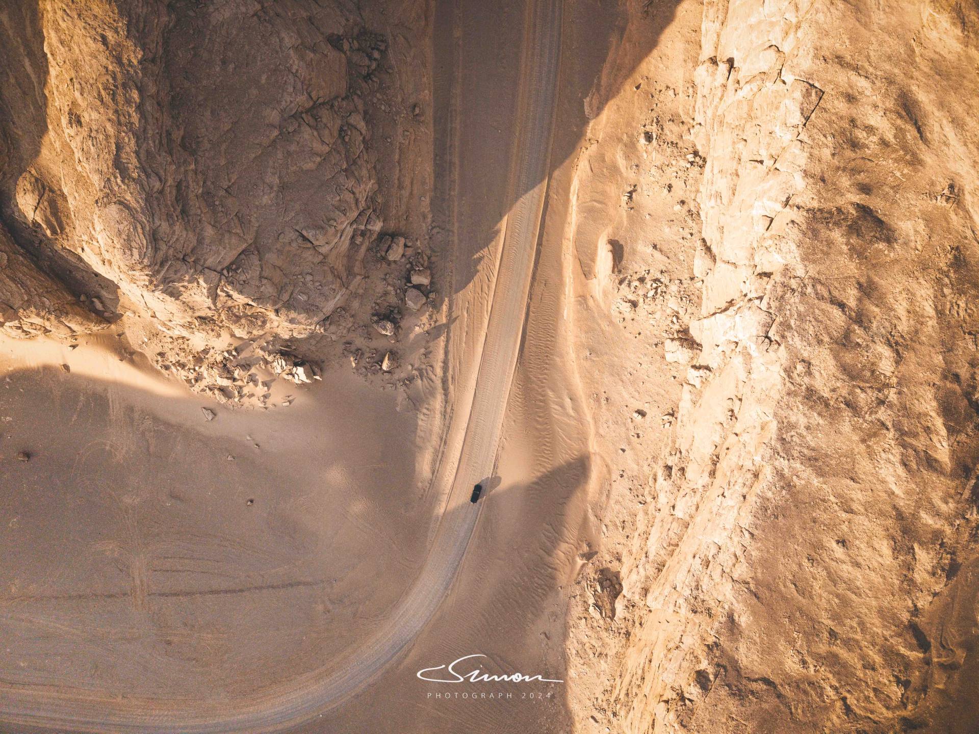
The vast and boundless Yardang landform group, towering remnants and ravines crisscrossing the desert, fully display the grandeur between heaven and earth. Every rock here is like a work of art meticulously carved by nature, with various shapes, some like ancient castles, some like giant beasts, and some like palaces with carved beams and painted columns. Standing on this desolate and vast land, one can feel time standing still, and the geological changes of hundreds of millions of years are vividly presented before our eyes.
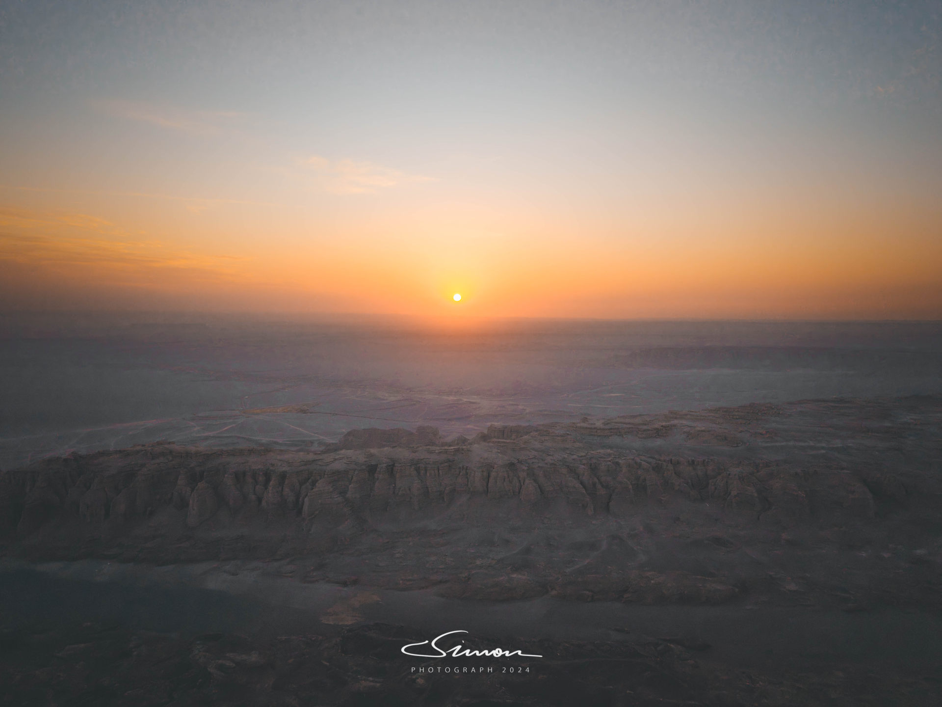
The process of traversing the Dahaidao is not only a visual feast but also a journey of dialogue with nature. The solitude, primitiveness, and tranquility here make people stay away from the hustle and bustle of the city and get close to nature. In the evening, when the afterglow of the sunset covers the entire Dahaidao, the silhouettes of the rocks appear particularly majestic against the golden-red sky, and the wind and sand gently rise in the distance, adding a layer of moving soft light to this land.
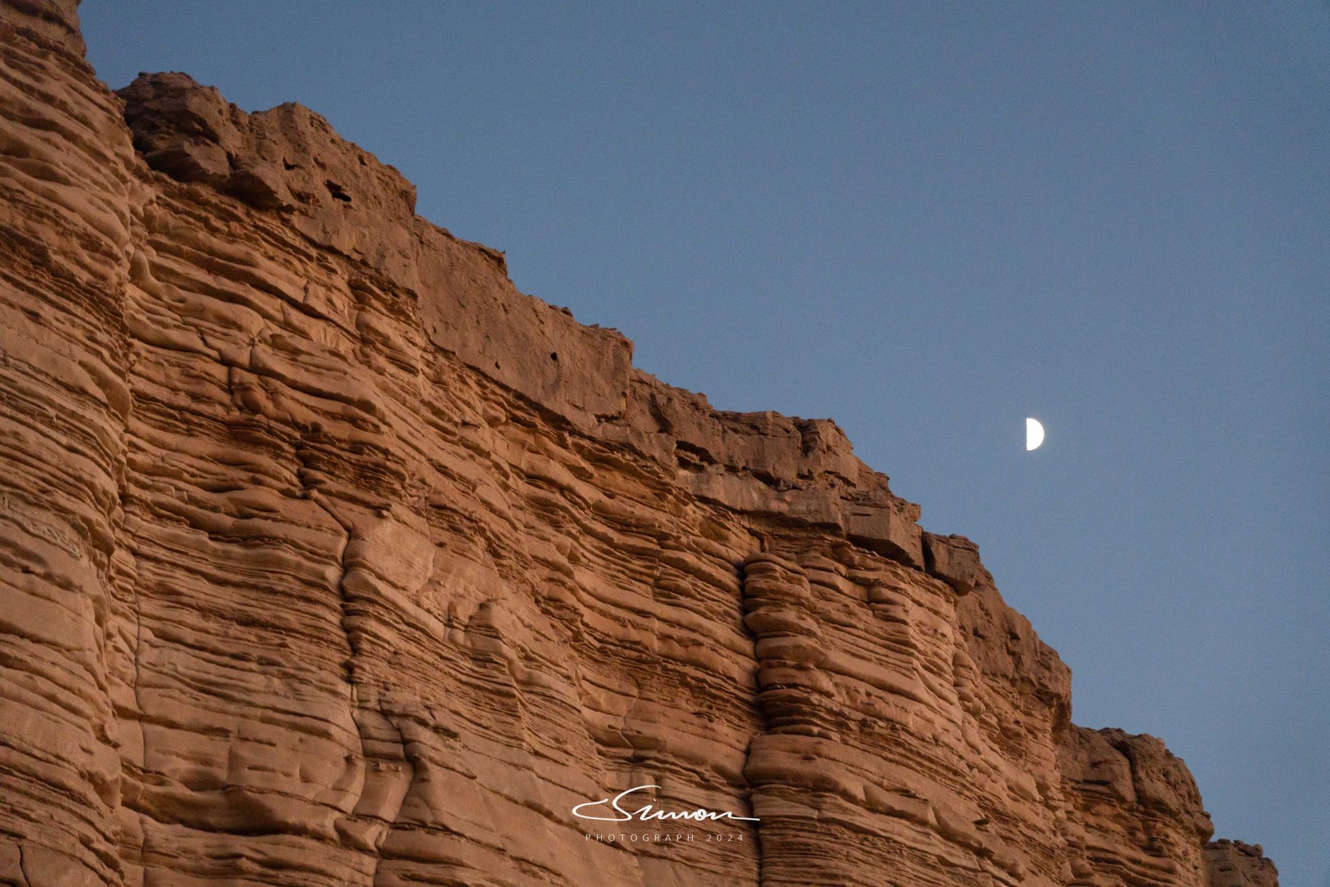
When the moon rose, we reluctantly returned. When we looked back at this desert wonder again, our hearts were filled with emotion. Hami Dahaidao was not only the end of the Northern Xinjiang trip but also one of the most shocking chapters of this journey. The desolation and grandeur of Dahaidao drew a perfect end to our Northern Xinjiang trip and also laid new expectations for the upcoming Southern Xinjiang trip.
Northern Xinjiang Finale and Southern Xinjiang Prelude
With the end of the Hami Dahaidao traverse, our Northern Xinjiang journey also came to a successful conclusion. From the clear waters and green mountains of Kanas Lake to the fairy tale world of Bahaiba Village, from the majestic depth of the China-Kazakhstan Border Grand Canyon to the sand sea wonder of Dahaidao, along the way, we lingered in the embrace of nature, deeply felt the magnificent landscape painting of Northern Xinjiang, and were shocked by the history and culture of this land.
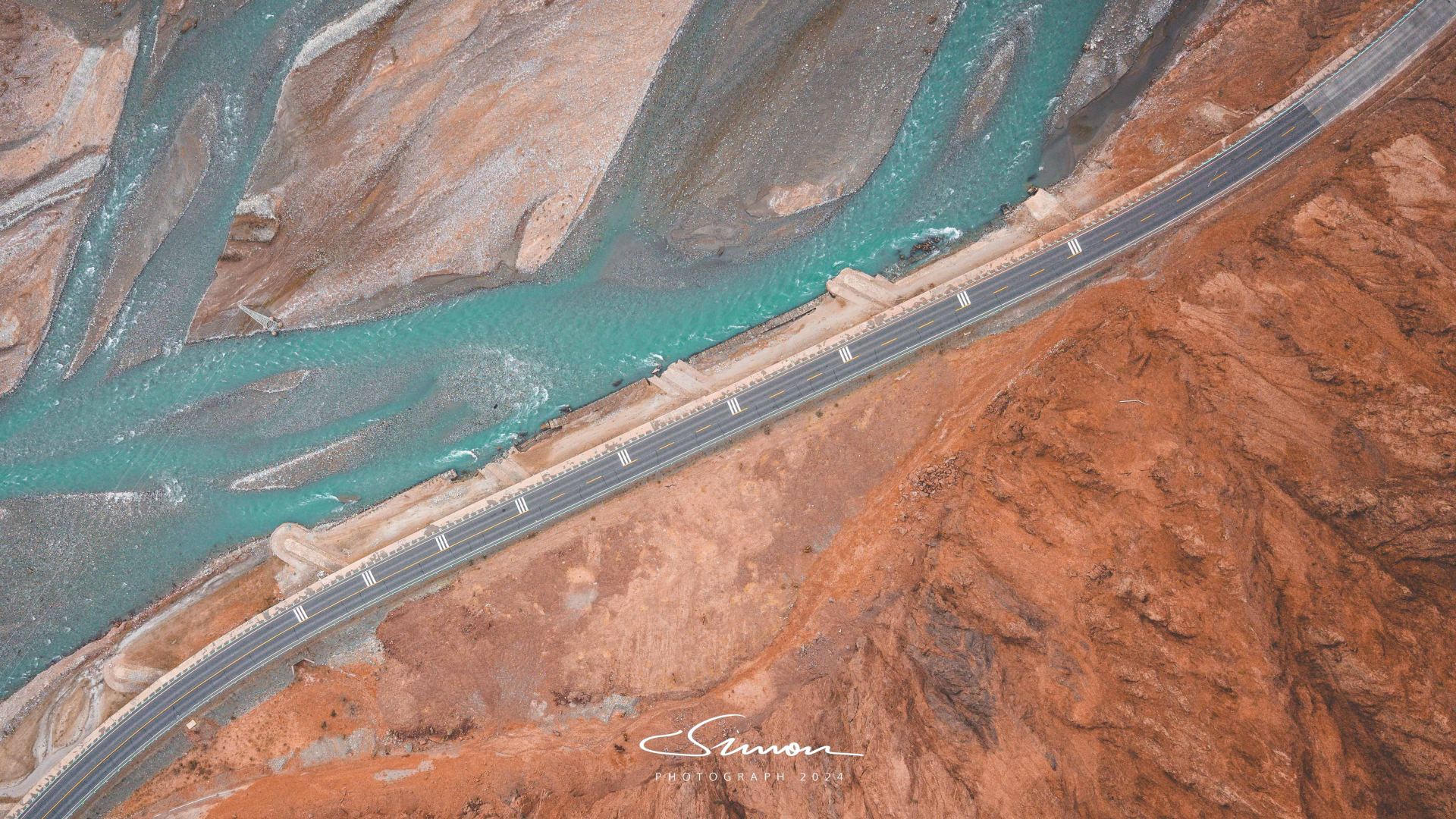
And the end of Northern Xinjiang is the beginning of the Southern Xinjiang journey. The next itinerary will lead us into a completely different world. In Southern Xinjiang, we will cross the Taklamakan Desert, visit the tranquil beauty of Baisha Lake, retrace Xuanzang's journey to the West – the Tashkurgan Ancient Road, and feel the desolation and grandeur of the ancient Silk Road. There are also brilliant Populus euphratica forests and magnificent red stone forests. The colorfulness and desolation of this land intertwine, bringing more unknowns and surprises to our journey.
If Northern Xinjiang is a magnificent landscape scroll, then Southern Xinjiang is a richly colored exotic picture album. The感動 (moving experiences) brought by Northern Xinjiang are unforgettable, and the unknown scenery of Southern Xinjiang is even more anticipated. With these thoughts, our journey continues forward, to appreciate another kind of magnificent and strange scenery, and to complete a deeper exploration and love for the land of Xinjiang.